Anyksciai geodata
Anyksciai (Utena) is a populated place; located in Lithuania in Europe/Vilnius (GMT+3) time zone. With population of 11,958 people, there are 42 cities with bigger population in this country. Compared to other cities in Lithuania, 67.2% of cities are located further ↓South; 78.4% of cities are located further ←West and 57.5% of cities have higher elevation than Anyksciai. Note1


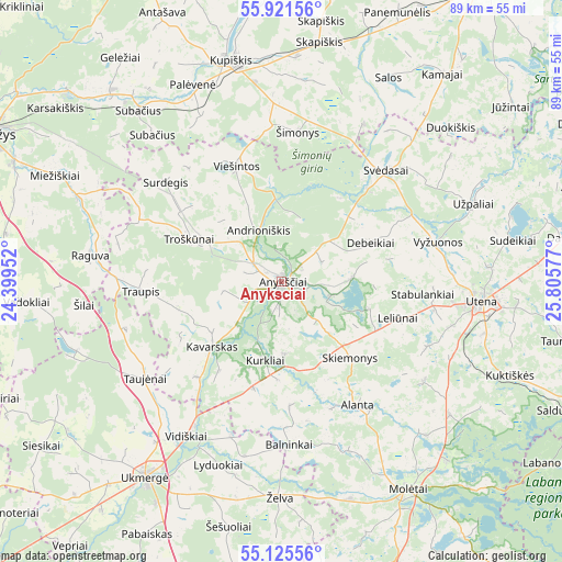
Anyksciai GPS coordinates[2]
55° 31' 32.052" North, 25° 6' 9.504" East
| Map corner | latitude | longitude |
|---|---|---|
| Upper-left | 55.92156°, | 24.39952° |
| Center: | 55.52557°, | 25.10264° |
| Lower-right: | 55.12556°, | 25.80577° |
| Map W x H: | 88.5×88.5 km | = 55×55mi |
| max Lat: | 56.36149° ⇑32.8% North |
| Anyksciai: | 55.52557° |
| min Lat: | ⇓67.2% South 54.01573° |
| min Long | Anyksciai | max Long |
| 20.99651° | 25.10264° | 26.43984° |
| W 78.4%⇐ | ⇒21.6% E |
Elevation
Elevation of Anyksciai is 74 m = 243 ft, and this is 16.7 m = 55 ft below average elevation for this country.
| Max E: |
204 m = 669 ft | 57.5% |
| Avg. | 90.7 m = 298 ft | |
| Anyksciai | 74 m = 243 ft | |
Min E: |
-1 m = -3 ft | 42.5% |
See also: Lithuania elevation on elevation.city.
Geographical zone
Anyksciai is located in North temperate zone (between Tropic of Cancer and the Arctic Circle). Distance of this North polar circle is 1227.3 km =762.6 mi to North.| Distance of | km | miles | from Anyksciai |
|---|---|---|---|
| North Pole | 3833.2 | 2381.8 | to North |
| Arctic Circle | 1227.3 | 762.6 | to North |
| Tropic Cancer | 3567.9 | 2217 | to South |
| Equator | 6173.9 | 3836.3 | to South |


Nearby cities:
15 places around Anyksciai: (largest is in red/bold)
• Dusetos
52.7 km =32.7 mi,  62°
62°
• Kavarskas
15 km =9.3 mi,  227°
227°
• Kupiskis
35.8 km =22.2 mi,  347°
347°
• Molėtai
38.9 km =24.2 mi,  149°
149°
• Naujamiestis
62.2 km =38.6 mi,  286°
286°
• Obeliai
49.4 km =30.7 mi,  3°
3°
• Pandėlys
56.2 km =34.9 mi,  7°
7°
• Panevėžys
52.6 km =32.7 mi,  296°
296°
• Ramygala
50.5 km =31.4 mi,  268°
268°
• Rokiškis
57.2 km =35.5 mi,  32°
32°
• Ukmerge
37.9 km =23.5 mi,  216°
216°
• Utena
31.4 km =19.5 mi,  95°
95°
• Vabalninkas
55.3 km =34.4 mi,  336°
336°
• Vepriai
53.4 km =33.2 mi, 218°
• Širvintos
54.4 km =33.8 mi,  189°
189°
Sources, notices
• [Note1] Compared only with cities in Lithuania existing in our database
• [Src1] Map data: © OpenStreetMap contributors (CC-BY-SA)
• [Src2] Other city data from geonames.org with taken over terms of usage.
• [Src3] Geographical zone / Annual Mean Temperature by Robert A. Rohde @ Wikipedia
