Berrechid geodata
Berrechid (Casablanca-Settat) is a seat of a third-order administrative division; located in Morocco in Africa/Casablanca (GMT+1) time zone. With population of 93,954 people, there are 26 cities with bigger population in this country. Compared to other cities in Morocco, 52.3% of cities are located further ↓South; 71.7% of cities are located further →East and 70.2% of cities have higher elevation than Berrechid. Note1


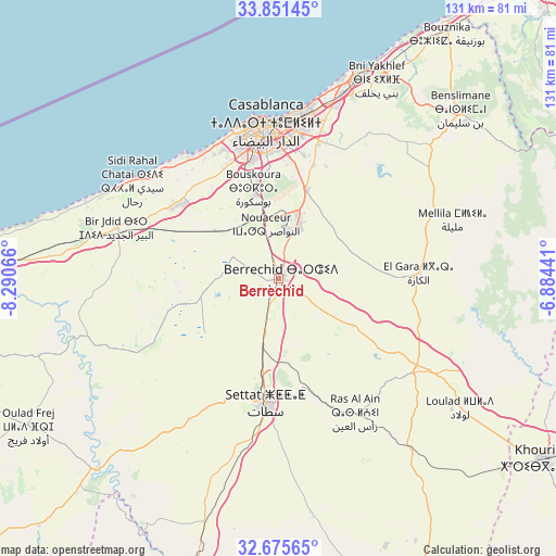
Berrechid GPS coordinates[2]
33° 15' 55.908" North, 7° 35' 15.144" West
| Map corner | latitude | longitude |
|---|---|---|
| Upper-left | 33.85145°, | -8.29066° |
| Center: | 33.26553°, | -7.58754° |
| Lower-right: | 32.67565°, | -6.88441° |
| Map W x H: | 130.7×130.7 km | = 81.2×81.2mi |
| max Lat: | 35.84906° ⇑47.7% North |
| Berrechid: | 33.26553° |
| min Lat: | ⇓52.3% South 22.6558° |
| min Long | Berrechid | max Long |
| -15.60719° | -7.58754° | -1.22855° |
| W 28.3%⇐ | ⇒71.7% E |
Elevation
Elevation of Berrechid is 220 m = 722 ft, and this is 396.8 m = 1302 ft below average elevation for this country.
| Max E: |
2637 m = 8652 ft | 70.2% |
| Avg. | 616.8 m = 2024 ft | |
| Berrechid | 220 m = 722 ft | |
Min E: |
1 m = 3 ft | 29.8% |
See also: Berrechid elevation on elevation.city.
Geographical zone
Berrechid is located in North temperate zone (between Tropic of Cancer and the Arctic Circle). Distance of this Northern Tropic circle is 1092.9 km =679.1 mi to South.| Distance of | km | miles | from Berrechid |
|---|---|---|---|
| North Pole | 6308.3 | 3919.8 | to North |
| Arctic Circle | 3702.4 | 2300.6 | to North |
| Tropic Cancer | 1092.9 | 679.1 | to South |
| Equator | 3698.8 | 2298.3 | to South |


Nearby cities:
15 places around Berrechid: (largest is in red/bold)
• Azemmour
70.2 km =43.6 mi,  272°
272°
• Boulaouane
62.7 km =39 mi,  224°
224°
• Bouskoura
21.4 km =13.3 mi,  343°
343°
• Bouznika
70.5 km =43.8 mi,  34°
34°
• Casablanca
36 km =22.4 mi,  356°
356°
• Dar Bouazza
35 km =21.7 mi,  322°
322°
• Guisser
56.1 km =34.9 mi,  171°
171°
• Mediouna
21.6 km =13.4 mi,  16°
16°
• Mellila
43.5 km =27 mi,  72°
72°
• Mohammedia
50.5 km =31.4 mi, 22°
• Oulad Frej
68.6 km =42.6 mi,  240°
240°
• Riah
23.5 km =14.6 mi,  122°
122°
• Settat
29.5 km =18.3 mi,  185°
185°
• Tit Mellil
33.9 km =21.1 mi, 16°
• Zawyat an Nwaçer
13 km =8.1 mi,  346°
346°
Sources, notices
• [Note1] Compared only with cities in Morocco existing in our database
• [Src1] Map data: © OpenStreetMap contributors (CC-BY-SA)
• [Src2] Other city data from geonames.org with taken over terms of usage.
• [Src3] Geographical zone / Annual Mean Temperature by Robert A. Rohde @ Wikipedia
