Figuig (Centre) geodata
Figuig (Centre) is a populated place; located in Morocco in Africa/Casablanca (GMT+1) time zone. With population of 12,516 people, there are 87 cities with bigger population in this country. Compared to other cities in Morocco, 64% of cities are located further ↑North; 100% of cities are located further ←West and 69% of cities have lower elevation than Figuig (Centre). Note1


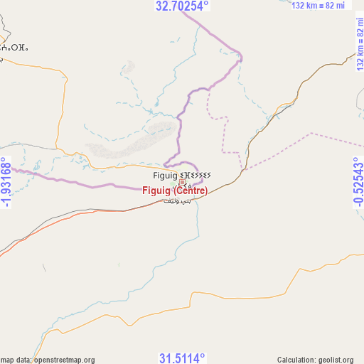
Figuig (Centre) GPS coordinates[2]
32° 6' 32.076" North, 1° 13' 42.78" West
| Map corner | latitude | longitude |
|---|---|---|
| Upper-left | 32.70254°, | -1.93168° |
| Center: | 32.10891°, | -1.22855° |
| Lower-right: | 31.5114°, | -0.52543° |
| Map W x H: | 132.4×132.4 km | = 82.3×82.3mi |
| max Lat: | 35.84906° ⇑64% North |
| Figuig (Centre): | 32.10891° |
| min Lat: | ⇓36% South 22.6558° |
| min Long | Figuig (Centre) | max Long |
| -15.60719° | -1.22855° | -1.22855° |
| W 100%⇐ | ⇒0% E |
Elevation
Elevation of Figuig (Centre) is 898 m = 2946 ft, and this is 281.2 m = 923 ft above average elevation for this country.
| Max E: |
2637 m = 8652 ft | 31% |
| Figuig (Centre) | 898 m 2946 ft | |
| Avg. | 616.8 m = 2024 ft | |
Min E: |
1 m = 3 ft | 69% |
See also: Morocco elevation on elevation.city.
Geographical zone
Figuig (Centre) is located in North temperate zone (between Tropic of Cancer and the Arctic Circle). Distance of this Northern Tropic circle is 964.3 km =599.2 mi to South.| Distance of | km | miles | from Figuig (Centre) |
|---|---|---|---|
| North Pole | 6436.9 | 3999.7 | to North |
| Arctic Circle | 3831 | 2380.5 | to North |
| Tropic Cancer | 964.3 | 599.2 | to South |
| Equator | 3570.2 | 2218.4 | to South |


Nearby cities:
15 places around Figuig (Centre): (largest is in red/bold)
• Almis Marmoucha
307.2 km =190.9 mi,  295°
295°
• Aoufous
281.7 km =175 mi,  260°
260°
• Arfoud
293.7 km =182.5 mi, 255°
• Aïn Beni Mathar
224.2 km =139.3 mi,  340°
340°
• Bouarfa
83.6 km =51.9 mi, 304°
• Debdou
268.3 km =166.7 mi,  320°
320°
• El Aïoun
299.6 km =186.2 mi, 336°
• Errachidia
302.1 km =187.7 mi,  266°
266°
• Guenfouda
274.7 km =170.7 mi, 343°
• Jerada
259.6 km =161.3 mi, 340°
• Missour
279 km =173.4 mi,  292°
292°
• Oujda-Angad
292.9 km =182 mi,  347°
347°
• Reçani
301.6 km =187.4 mi,  252°
252°
• Taourirt
299 km =185.8 mi,  328°
328°
• Tiouli
257.3 km =159.9 mi, 347°
Sources, notices
• [Note1] Compared only with cities in Morocco existing in our database
• [Src1] Map data: © OpenStreetMap contributors (CC-BY-SA)
• [Src2] Other city data from geonames.org with taken over terms of usage.
• [Src3] Geographical zone / Annual Mean Temperature by Robert A. Rohde @ Wikipedia
