Tranovaho geodata
Tranovaho (Androy) is a populated place; located in Madagascar in Indian/Antananarivo (GMT+3) time zone. With population of 13,000 people, there are 86 cities with bigger population in this country. Compared to other cities in Madagascar, 100% of cities are located further ↑North; 90.2% of cities are located further →East and 53.7% of cities have higher elevation than Tranovaho. Note1
Administrative division(s):
- Level 1: Androy
- Level 2: Beloha District
- Level 3: Tranovaho
- Level 4: Tranovaho


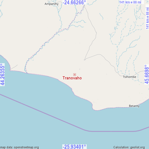
Tranovaho GPS coordinates[2]
25° 18' 0" South, 44° 58' 0.012" East
| Map corner | latitude | longitude |
|---|---|---|
| Upper-left | -24.66266°, | 44.26355° |
| Center: | -25.3°, | 44.96667° |
| Lower-right: | -25.93401°, | 45.6698° |
| Map W x H: | 141.4×141.4 km | = 87.9×87.9mi |
| max Lat: | -12.31732° ⇑100% North |
| Tranovaho: | -25.3° |
| min Lat: | ⇓0% South -25.3° |
| min Long | Tranovaho | max Long |
| 43.65° | 44.96667° | 50.27876° |
| W 9.8%⇐ | ⇒90.2% E |
Elevation
Elevation of Tranovaho is 189 m = 620 ft, and this is 368.4 m = 1209 ft below average elevation for this country.
| Max E: |
1763 m = 5784 ft | 53.7% |
| Avg. | 557.4 m = 1829 ft | |
| Tranovaho | 189 m = 620 ft | |
Min E: |
1 m = 3 ft | 46.3% |
See also: Madagascar elevation on elevation.city.
Geographical zone
Tranovaho is located in South temperate zone (between Tropic of Capricorn and the Antarctic Circle). Distance of this Southern Tropic circle is 207.2 km =128.7 mi to North.| Distance of | km | miles | from Tranovaho |
|---|---|---|---|
| Equator | 2813.1 | 1748 | to North |
| Tropic Capricorn | 207.2 | 128.7 | to North |
| Antarctic Circle | 4588.1 | 2850.9 | to South |
| South Pole | 7194 | 4470.1 | to South |


Nearby cities:
15 places around Tranovaho: (largest is in red/bold)
• Ambalasoa
264.4 km =164.3 mi,  23°
23°
• Amboasary
145.6 km =90.5 mi,  78°
78°
• Amboasary
146.3 km =90.9 mi,  42°
42°
• Ambovombe
113.5 km =70.5 mi, 83°
• Ampanihy
71 km =44.1 mi,  341°
341°
• Anakao
225.2 km =139.9 mi,  323°
323°
• Antanimena
213.4 km =132.6 mi, 335°
• Behompy
254.5 km =158.1 mi,  333°
333°
• Beloha
17 km =10.6 mi,  29°
29°
• Beteza
95.7 km =59.5 mi,  9°
9°
• Betioky
185.3 km =115.1 mi, 341°
• Kopoky
26 km =16.2 mi,  64°
64°
• Toliara
253.7 km =157.6 mi, 328°
• Tsiombe
51.9 km =32.2 mi,  90°
90°
• Tôlanaro
205.1 km =127.4 mi, 81°
Sources, notices
• [Note1] Compared only with cities in Madagascar existing in our database
• [Src1] Map data: © OpenStreetMap contributors (CC-BY-SA)
• [Src2] Other city data from geonames.org with taken over terms of usage.
• [Src3] Geographical zone / Annual Mean Temperature by Robert A. Rohde @ Wikipedia
