Tsiombe geodata
Tsiombe (Androy) is a populated place; located in Madagascar in Indian/Antananarivo (GMT+3) time zone. With population of 29,825 people, there are 33 cities with bigger population in this country. Compared to other cities in Madagascar, 100% of cities are located further ↑North; 83.7% of cities are located further →East and 64.2% of cities have higher elevation than Tsiombe. Note1


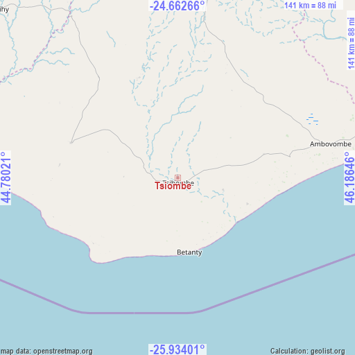
Tsiombe GPS coordinates[2]
25° 18' 0" South, 45° 28' 59.988" East
| Map corner | latitude | longitude |
|---|---|---|
| Upper-left | -24.66266°, | 44.78021° |
| Center: | -25.3°, | 45.48333° |
| Lower-right: | -25.93401°, | 46.18646° |
| Map W x H: | 141.4×141.4 km | = 87.9×87.9mi |
| max Lat: | -12.31732° ⇑100% North |
| Tsiombe: | -25.3° |
| min Lat: | ⇓0% South -25.3° |
| min Long | Tsiombe | max Long |
| 43.65° | 45.48333° | 50.27876° |
| W 16.3%⇐ | ⇒83.7% E |
Elevation
Elevation of Tsiombe is 66 m = 217 ft, and this is 491.4 m = 1612 ft below average elevation for this country.
| Max E: |
1763 m = 5784 ft | 64.2% |
| Avg. | 557.4 m = 1829 ft | |
| Tsiombe | 66 m = 217 ft | |
Min E: |
1 m = 3 ft | 35.8% |
See also: Madagascar elevation on elevation.city.
Geographical zone
Tsiombe is located in South temperate zone (between Tropic of Capricorn and the Antarctic Circle). Distance of this Southern Tropic circle is 207.2 km =128.7 mi to North.| Distance of | km | miles | from Tsiombe |
|---|---|---|---|
| Equator | 2813.1 | 1748 | to North |
| Tropic Capricorn | 207.2 | 128.7 | to North |
| Antarctic Circle | 4588.1 | 2850.9 | to South |
| South Pole | 7194 | 4470.1 | to South |


Nearby cities:
15 places around Tsiombe: (largest is in red/bold)
• Ambalasoa
248.4 km =154.3 mi,  12°
12°
• Amboasary
95.3 km =59.2 mi,  71°
71°
• Amboasary
117.3 km =72.9 mi,  23°
23°
• Ambovombe
62.2 km =38.6 mi,  77°
77°
• Ampanihy
100.3 km =62.3 mi,  312°
312°
• Anakao
259.6 km =161.3 mi, 314°
• Antanimena
239.7 km =148.9 mi,  324°
324°
• Behompy
281.7 km =175 mi, 324°
• Beloha
46 km =28.6 mi,  288°
288°
• Beteza
101.5 km =63.1 mi,  338°
338°
• Betioky
208 km =129.2 mi,  327°
327°
• Kopoky
30.6 km =19 mi, 291°
• Tranovaho
51.9 km =32.2 mi,  270°
270°
• Tôlanaro
153.9 km =95.6 mi, 78°
• Vohipaho
282 km =175.2 mi,  46°
46°
Sources, notices
• [Note1] Compared only with cities in Madagascar existing in our database
• [Src1] Map data: © OpenStreetMap contributors (CC-BY-SA)
• [Src2] Other city data from geonames.org with taken over terms of usage.
• [Src3] Geographical zone / Annual Mean Temperature by Robert A. Rohde @ Wikipedia
