Antanimena geodata
Antanimena (Atsimo-Andrefana) is a populated place; located in Madagascar in Indian/Antananarivo (GMT+3) time zone. With population of 4,000 people, there are 112 cities with bigger population in this country. Compared to other cities in Madagascar, 90.2% of cities are located further ↑North; 96.7% of cities are located further →East and 62.6% of cities have higher elevation than Antanimena. Note1
Administrative division(s):
- Level 1: Atsimo-Andrefana
- Level 2: Toliara II District
- Level 3: Antanimena Onilahy
- Level 4: Anatsakoa


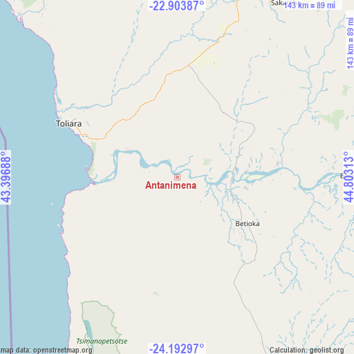
Antanimena GPS coordinates[2]
23° 33' 0" South, 44° 6' 0" East
| Map corner | latitude | longitude |
|---|---|---|
| Upper-left | -22.90387°, | 43.39688° |
| Center: | -23.55°, | 44.1° |
| Lower-right: | -24.19297°, | 44.80313° |
| Map W x H: | 143.3×143.3 km | = 89×89mi |
| max Lat: | -12.31732° ⇑90.2% North |
| Antanimena: | -23.55° |
| min Lat: | ⇓9.8% South -25.3° |
| min Long | Antanimena | max Long |
| 43.65° | 44.1° | 50.27876° |
| W 3.3%⇐ | ⇒96.7% E |
Elevation
Elevation of Antanimena is 79 m = 259 ft, and this is 478.4 m = 1570 ft below average elevation for this country.
| Max E: |
1763 m = 5784 ft | 62.6% |
| Avg. | 557.4 m = 1829 ft | |
| Antanimena | 79 m = 259 ft | |
Min E: |
1 m = 3 ft | 37.4% |
See also: Madagascar elevation on elevation.city.
Geographical zone
Antanimena is located in South temperate zone (between Tropic of Capricorn and the Antarctic Circle). Distance of this Southern Tropic circle is 12.6 km =7.8 mi to North.| Distance of | km | miles | from Antanimena |
|---|---|---|---|
| Equator | 2618.5 | 1627.1 | to North |
| Tropic Capricorn | 12.6 | 7.8 | to North |
| Antarctic Circle | 4782.7 | 2971.8 | to South |
| South Pole | 7388.5 | 4591 | to South |


Nearby cities:
15 places around Antanimena: (largest is in red/bold)
• Ambalasoa
199.9 km =124.2 mi,  76°
76°
• Amboasary
207.2 km =128.7 mi,  114°
114°
• Ampanihy
143.1 km =88.9 mi,  152°
152°
• Anakao
47.6 km =29.6 mi,  254°
254°
• Ankazoabo
147.2 km =91.5 mi,  16°
16°
• Behompy
42 km =26.1 mi,  322°
322°
• Beloha
203.9 km =126.7 mi, 151°
• Beroroha
236.3 km =146.8 mi,  27°
27°
• Beteza
143.8 km =89.4 mi,  134°
134°
• Betioky
34.3 km =21.3 mi,  123°
123°
• Kopoky
214.6 km =133.3 mi, 148°
• Ranohira
178.2 km =110.7 mi,  48°
48°
• Sakaraha
84.8 km =52.7 mi, 31°
• Toliara
49.5 km =30.8 mi,  296°
296°
• Tranovaho
213.4 km =132.6 mi,  155°
155°
Sources, notices
• [Note1] Compared only with cities in Madagascar existing in our database
• [Src1] Map data: © OpenStreetMap contributors (CC-BY-SA)
• [Src2] Other city data from geonames.org with taken over terms of usage.
• [Src3] Geographical zone / Annual Mean Temperature by Robert A. Rohde @ Wikipedia
