Behompy geodata
Behompy (Atsimo-Andrefana) is a populated place; located in Madagascar in Indian/Antananarivo (GMT+3) time zone. With population of 7,000 people, there are 102 cities with bigger population in this country. Compared to other cities in Madagascar, 87% of cities are located further ↑North; 98.4% of cities are located further →East and 69.1% of cities have higher elevation than Behompy. Note1
Administrative division(s):
- Level 1: Atsimo-Andrefana
- Level 2: Toliara II District
- Level 3: Behompy
- Level 4: Ampasy


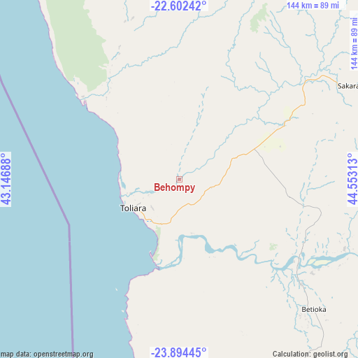
Behompy GPS coordinates[2]
23° 15' 0" South, 43° 51' 0" East
| Map corner | latitude | longitude |
|---|---|---|
| Upper-left | -22.60242°, | 43.14688° |
| Center: | -23.25°, | 43.85° |
| Lower-right: | -23.89445°, | 44.55313° |
| Map W x H: | 143.7×143.7 km | = 89.3×89.3mi |
| max Lat: | -12.31732° ⇑87% North |
| Behompy: | -23.25° |
| min Lat: | ⇓13% South -25.3° |
| min Long | Behompy | max Long |
| 43.65° | 43.85° | 50.27876° |
| W 1.6%⇐ | ⇒98.4% E |
Elevation
Elevation of Behompy is 49 m = 161 ft, and this is 508.4 m = 1668 ft below average elevation for this country.
| Max E: |
1763 m = 5784 ft | 69.1% |
| Avg. | 557.4 m = 1829 ft | |
| Behompy | 49 m = 161 ft | |
Min E: |
1 m = 3 ft | 30.9% |
See also: Madagascar elevation on elevation.city.
Geographical zone
Behompy is located in South Torrid zone (between Equator and Tropic of Capricorn). Distance of this Southern Tropic circle is 20.8 km =12.9 mi to South.| Distance of | km | miles | from Behompy |
|---|---|---|---|
| Equator | 2585.2 | 1606.4 | to North |
| Tropic Capricorn | 20.8 | 12.9 | to South |
| Antarctic Circle | 4816 | 2992.5 | to South |
| South Pole | 7421.9 | 4611.8 | to South |


Nearby cities:
15 places around Behompy: (largest is in red/bold)
• Ambalasoa
220.3 km =136.9 mi,  86°
86°
• Amboasary
245.3 km =152.4 mi,  119°
119°
• Ampanihy
184.5 km =114.6 mi,  150°
150°
• Anakao
50.6 km =31.4 mi,  203°
203°
• Ankazoabo
127.4 km =79.2 mi,  32°
32°
• Antanimena
42 km =26.1 mi,  142°
142°
• Beloha
245.4 km =152.5 mi, 150°
• Beroroha
222 km =137.9 mi,  37°
37°
• Beteza
185.5 km =115.3 mi, 136°
• Betioky
75.3 km =46.8 mi,  134°
134°
• Ihosy
251.5 km =156.3 mi,  68°
68°
• Manja
208 km =129.2 mi,  13°
13°
• Ranohira
180.2 km =112 mi,  61°
61°
• Sakaraha
80 km =49.7 mi, 60°
• Toliara
21.8 km =13.5 mi,  239°
239°
Sources, notices
• [Note1] Compared only with cities in Madagascar existing in our database
• [Src1] Map data: © OpenStreetMap contributors (CC-BY-SA)
• [Src2] Other city data from geonames.org with taken over terms of usage.
• [Src3] Geographical zone / Annual Mean Temperature by Robert A. Rohde @ Wikipedia
