Beloha geodata
Beloha (Androy) is a populated place; located in Madagascar in Indian/Antananarivo (GMT+3) time zone. With population of 23,021 people, there are 54 cities with bigger population in this country. Compared to other cities in Madagascar, 96.7% of cities are located further ↑North; 89.4% of cities are located further →East and 56.9% of cities have higher elevation than Beloha. Note1
Administrative division(s):
- Level 1: Androy
- Level 2: Beloha District
- Level 3: Beloha
- Level 4: Zambe Beloha


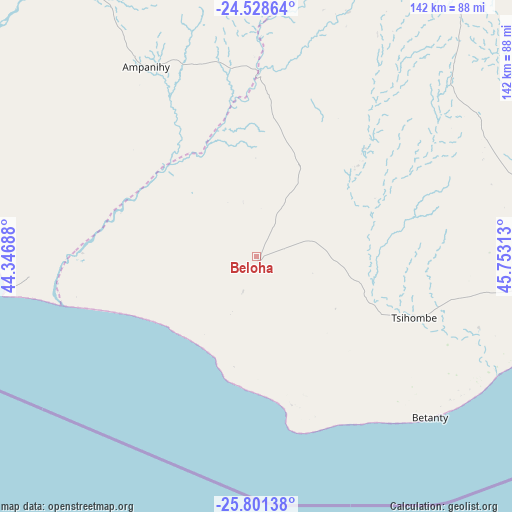
Beloha GPS coordinates[2]
25° 10' 0.012" South, 45° 3' 0" East
| Map corner | latitude | longitude |
|---|---|---|
| Upper-left | -24.52864°, | 44.34688° |
| Center: | -25.16667°, | 45.05° |
| Lower-right: | -25.80138°, | 45.75313° |
| Map W x H: | 141.5×141.5 km | = 87.9×87.9mi |
| max Lat: | -12.31732° ⇑96.7% North |
| Beloha: | -25.16667° |
| min Lat: | ⇓3.3% South -25.3° |
| min Long | Beloha | max Long |
| 43.65° | 45.05° | 50.27876° |
| W 10.6%⇐ | ⇒89.4% E |
Elevation
Elevation of Beloha is 156 m = 512 ft, and this is 401.4 m = 1317 ft below average elevation for this country.
| Max E: |
1763 m = 5784 ft | 56.9% |
| Avg. | 557.4 m = 1829 ft | |
| Beloha | 156 m = 512 ft | |
Min E: |
1 m = 3 ft | 43.1% |
See also: Madagascar elevation on elevation.city.
Geographical zone
Beloha is located in South temperate zone (between Tropic of Capricorn and the Antarctic Circle). Distance of this Southern Tropic circle is 192.4 km =119.6 mi to North.| Distance of | km | miles | from Beloha |
|---|---|---|---|
| Equator | 2798.3 | 1738.8 | to North |
| Tropic Capricorn | 192.4 | 119.6 | to North |
| Antarctic Circle | 4602.9 | 2860.1 | to South |
| South Pole | 7208.8 | 4479.3 | to South |


Nearby cities:
15 places around Beloha: (largest is in red/bold)
• Ambalasoa
247.5 km =153.8 mi,  22°
22°
• Amboasary
129.8 km =80.7 mi,  44°
44°
• Amboasary
135.1 km =83.9 mi,  83°
83°
• Ambovombe
104.4 km =64.9 mi,  90°
90°
• Ampanihy
60.9 km =37.8 mi,  329°
329°
• Anakao
218.9 km =136 mi,  319°
319°
• Antanimena
203.9 km =126.7 mi, 331°
• Behompy
245.4 km =152.5 mi, 330°
• Beteza
80 km =49.7 mi,  4°
4°
• Betioky
174.5 km =108.4 mi,  337°
337°
• Kopoky
15.5 km =9.6 mi,  103°
103°
• Toliara
245.9 km =152.8 mi, 325°
• Tranovaho
17 km =10.6 mi,  209°
209°
• Tsiombe
46 km =28.6 mi,  108°
108°
• Tôlanaro
195.2 km =121.3 mi, 85°
Sources, notices
• [Note1] Compared only with cities in Madagascar existing in our database
• [Src1] Map data: © OpenStreetMap contributors (CC-BY-SA)
• [Src2] Other city data from geonames.org with taken over terms of usage.
• [Src3] Geographical zone / Annual Mean Temperature by Robert A. Rohde @ Wikipedia
