Tôlanaro geodata
Tôlanaro (Anosy) is a seat of a first-order administrative division; located in Madagascar in Indian/Antananarivo (GMT+3) time zone. With population of 45,141 people, there are 11 cities with bigger population in this country. Compared to other cities in Madagascar, 95.1% of cities are located further ↑North; 66.7% of cities are located further →East and 73.2% of cities have higher elevation than Tôlanaro. Note1


Tôlanaro GPS coordinates[2]
25° 1' 56.964" South, 46° 58' 59.844" East
| Map corner | latitude | longitude |
|---|---|---|
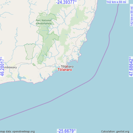
| Upper-left | -24.39377°, | 46.28017° |
| Center: | -25.03249°, | 46.98329° |
| Lower-right: | -25.6679°, | 47.68642° |
| Map W x H: | 141.7×141.7 km | = 88×88mi |
| max Lat: | -12.31732° ⇑95.1% North |
| Tôlanaro: | -25.03249° |
| min Lat: | ⇓4.9% South -25.3° |
| min Long | Tôlanaro | max Long |
| 43.65° | 46.98329° | 50.27876° |
| W 33.3%⇐ | ⇒66.7% E |
Elevation
Elevation of Tôlanaro is 27 m = 89 ft, and this is 530.4 m = 1740 ft below average elevation for this country.
| Max E: |
1763 m = 5784 ft | 73.2% |
| Avg. | 557.4 m = 1829 ft | |
| Tôlanaro | 27 m = 89 ft | |
Min E: |
1 m = 3 ft | 26.8% |
See also: Tôlanaro elevation on elevation.city.
Geographical zone
Tôlanaro is located in South temperate zone (between Tropic of Capricorn and the Antarctic Circle). Distance of this Southern Tropic circle is 177.4 km =110.2 mi to North.| Distance of | km | miles | from Tôlanaro |
|---|---|---|---|
| Equator | 2783.4 | 1729.5 | to North |
| Tropic Capricorn | 177.4 | 110.2 | to North |
| Antarctic Circle | 4617.8 | 2869.4 | to South |
| South Pole | 7223.7 | 4488.6 | to South |


Nearby cities:
15 places around Tôlanaro: (largest is in red/bold)
• Ambalasoa
235.2 km =146.1 mi,  334°
334°
• Amboasary
60.4 km =37.5 mi,  269°
269°
• Amboasary
130.2 km =80.9 mi,  306°
306°
• Ambovombe
91.7 km =57 mi,  259°
259°
• Ampanihy
228.8 km =142.2 mi,  279°
279°
• Anandravy
240.3 km =149.3 mi,  9°
9°
• Beloha
195.2 km =121.3 mi, 265°
• Beteza
199.3 km =123.8 mi,  288°
288°
• Farafangana
260.3 km =161.7 mi,  19°
19°
• Kopoky
180.5 km =112.2 mi, 264°
• Tranovaho
205.1 km =127.4 mi, 261°
• Tsiombe
153.9 km =95.6 mi, 258°
• Vangaindrano
197.3 km =122.6 mi, 18°
• Vohipaho
173 km =107.5 mi, 17°
• Vondrozo
248.3 km =154.3 mi, 7°
Sources, notices
• [Note1] Compared only with cities in Madagascar existing in our database
• [Src1] Map data: © OpenStreetMap contributors (CC-BY-SA)
• [Src2] Other city data from geonames.org with taken over terms of usage.
• [Src3] Geographical zone / Annual Mean Temperature by Robert A. Rohde @ Wikipedia
