Beteza geodata
Beteza (Androy) is a populated place; located in Madagascar in Indian/Antananarivo (GMT+3) time zone. With population of 7,000 people, there are 102 cities with bigger population in this country. Compared to other cities in Madagascar, 93.5% of cities are located further ↑North; 88.6% of cities are located further →East and 53.7% of cities have lower elevation than Beteza. Note1
Administrative division(s):
- Level 1: Androy
- Level 2: Bekily District
- Level 3: Beteza
- Level 4: Beteza Centre


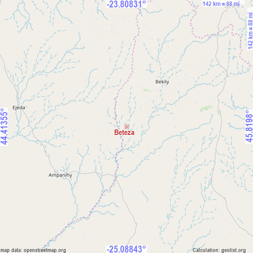
Beteza GPS coordinates[2]
24° 27' 0" South, 45° 7' 0.012" East
| Map corner | latitude | longitude |
|---|---|---|
| Upper-left | -23.80831°, | 44.41355° |
| Center: | -24.45°, | 45.11667° |
| Lower-right: | -25.08843°, | 45.8198° |
| Map W x H: | 142.3×142.3 km | = 88.4×88.4mi |
| max Lat: | -12.31732° ⇑93.5% North |
| Beteza: | -24.45° |
| min Lat: | ⇓6.5% South -25.3° |
| min Long | Beteza | max Long |
| 43.65° | 45.11667° | 50.27876° |
| W 11.4%⇐ | ⇒88.6% E |
Elevation
Elevation of Beteza is 304 m = 997 ft, and this is 253.4 m = 831 ft below average elevation for this country.
| Max E: |
1763 m = 5784 ft | 46.3% |
| Avg. | 557.4 m = 1829 ft | |
| Beteza | 304 m = 997 ft | |
Min E: |
1 m = 3 ft | 53.7% |
See also: Madagascar elevation on elevation.city.
Geographical zone
Beteza is located in South temperate zone (between Tropic of Capricorn and the Antarctic Circle). Distance of this Southern Tropic circle is 112.7 km =70 mi to North.| Distance of | km | miles | from Beteza |
|---|---|---|---|
| Equator | 2718.6 | 1689.3 | to North |
| Tropic Capricorn | 112.7 | 70 | to North |
| Antarctic Circle | 4682.6 | 2909.6 | to South |
| South Pole | 7288.5 | 4528.9 | to South |


Nearby cities:
15 places around Beteza: (largest is in red/bold)
• Ambalasoa
173.4 km =107.7 mi,  31°
31°
• Amboasary
85.4 km =53.1 mi,  81°
81°
• Amboasary
143.4 km =89.1 mi,  116°
116°
• Ambovombe
127.1 km =79 mi,  129°
129°
• Ampanihy
46.3 km =28.8 mi,  234°
234°
• Anakao
172.5 km =107.2 mi,  300°
300°
• Antanimena
143.8 km =89.4 mi,  314°
314°
• Behompy
185.5 km =115.3 mi,  316°
316°
• Beloha
80 km =49.7 mi,  184°
184°
• Betioky
110.3 km =68.5 mi, 317°
• Kopoky
83.8 km =52.1 mi,  174°
174°
• Sakaraha
182.3 km =113.3 mi,  340°
340°
• Toliara
191.5 km =119 mi, 309°
• Tranovaho
95.7 km =59.5 mi,  189°
189°
• Tsiombe
101.5 km =63.1 mi,  158°
158°
Sources, notices
• [Note1] Compared only with cities in Madagascar existing in our database
• [Src1] Map data: © OpenStreetMap contributors (CC-BY-SA)
• [Src2] Other city data from geonames.org with taken over terms of usage.
• [Src3] Geographical zone / Annual Mean Temperature by Robert A. Rohde @ Wikipedia
