Kopoky geodata
Kopoky (Androy) is a populated place; located in Madagascar in Indian/Antananarivo (GMT+3) time zone. With population of 15,000 people, there are 84 cities with bigger population in this country. Compared to other cities in Madagascar, 98.4% of cities are located further ↑North; 87% of cities are located further →East and 59.3% of cities have higher elevation than Kopoky. Note1
Administrative division(s):
- Level 1: Androy
- Level 2: Beloha District
- Level 3: Kopoky
- Level 4: Afondravoatse Nord


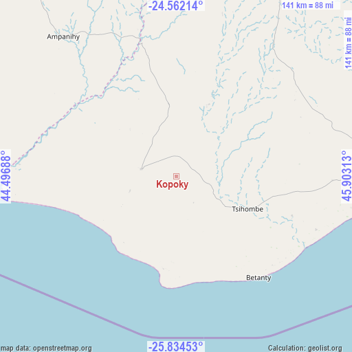
Kopoky GPS coordinates[2]
25° 12' 0" South, 45° 12' 0" East
| Map corner | latitude | longitude |
|---|---|---|
| Upper-left | -24.56214°, | 44.49688° |
| Center: | -25.2°, | 45.2° |
| Lower-right: | -25.83453°, | 45.90313° |
| Map W x H: | 141.5×141.5 km | = 87.9×87.9mi |
| max Lat: | -12.31732° ⇑98.4% North |
| Kopoky: | -25.2° |
| min Lat: | ⇓1.6% South -25.3° |
| min Long | Kopoky | max Long |
| 43.65° | 45.2° | 50.27876° |
| W 13%⇐ | ⇒87% E |
Elevation
Elevation of Kopoky is 127 m = 417 ft, and this is 430.4 m = 1412 ft below average elevation for this country.
| Max E: |
1763 m = 5784 ft | 59.3% |
| Avg. | 557.4 m = 1829 ft | |
| Kopoky | 127 m = 417 ft | |
Min E: |
1 m = 3 ft | 40.7% |
See also: Madagascar elevation on elevation.city.
Geographical zone
Kopoky is located in South temperate zone (between Tropic of Capricorn and the Antarctic Circle). Distance of this Southern Tropic circle is 196.1 km =121.9 mi to North.| Distance of | km | miles | from Kopoky |
|---|---|---|---|
| Equator | 2802 | 1741.1 | to North |
| Tropic Capricorn | 196.1 | 121.9 | to North |
| Antarctic Circle | 4599.2 | 2857.8 | to South |
| South Pole | 7205.1 | 4477 | to South |


Nearby cities:
15 places around Kopoky: (largest is in red/bold)
• Ambalasoa
245.4 km =152.5 mi,  19°
19°
• Amboasary
120.6 km =74.9 mi,  81°
81°
• Amboasary
122.6 km =76.2 mi,  38°
38°
• Ambovombe
89.3 km =55.5 mi,  88°
88°
• Ampanihy
72.6 km =45.1 mi,  320°
320°
• Anakao
231.7 km =144 mi, 317°
• Antanimena
214.6 km =133.3 mi,  328°
328°
• Behompy
256.4 km =159.3 mi, 327°
• Beloha
15.5 km =9.6 mi,  283°
283°
• Beteza
83.8 km =52.1 mi,  354°
354°
• Betioky
184.2 km =114.5 mi, 333°
• Toliara
257.8 km =160.2 mi, 322°
• Tranovaho
26 km =16.2 mi,  244°
244°
• Tsiombe
30.6 km =19 mi,  111°
111°
• Tôlanaro
180.5 km =112.2 mi, 84°
Sources, notices
• [Note1] Compared only with cities in Madagascar existing in our database
• [Src1] Map data: © OpenStreetMap contributors (CC-BY-SA)
• [Src2] Other city data from geonames.org with taken over terms of usage.
• [Src3] Geographical zone / Annual Mean Temperature by Robert A. Rohde @ Wikipedia
