Vondrozo geodata
Vondrozo (Atsimo-Atsinanana) is a populated place; located in Madagascar in Indian/Antananarivo (GMT+3) time zone. With population of 19,949 people, there are 66 cities with bigger population in this country. Compared to other cities in Madagascar, 82.9% of cities are located further ↑North; 59.3% of cities are located further →East and 61% of cities have lower elevation than Vondrozo. Note1
Administrative division(s):
- Level 1: Atsimo-Atsinanana
- Level 2: Vondrozo
- Level 3: Vondrozo
- Level 4: Antevongo


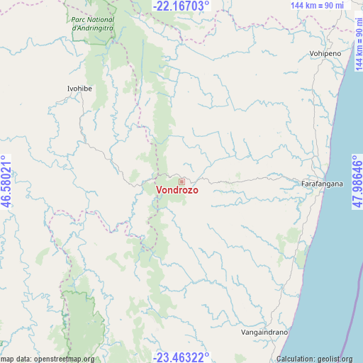
Vondrozo GPS coordinates[2]
22° 49' 0.012" South, 47° 16' 59.988" East
| Map corner | latitude | longitude |
|---|---|---|
| Upper-left | -22.16703°, | 46.58021° |
| Center: | -22.81667°, | 47.28333° |
| Lower-right: | -23.46322°, | 47.98646° |
| Map W x H: | 144.1×144.1 km | = 89.5×89.5mi |
| max Lat: | -12.31732° ⇑82.9% North |
| Vondrozo: | -22.81667° |
| min Lat: | ⇓17.1% South -25.3° |
| min Long | Vondrozo | max Long |
| 43.65° | 47.28333° | 50.27876° |
| W 40.7%⇐ | ⇒59.3% E |
Elevation
Elevation of Vondrozo is 485 m = 1591 ft, and this is 72.4 m = 238 ft below average elevation for this country.
| Max E: |
1763 m = 5784 ft | 39% |
| Avg. | 557.4 m = 1829 ft | |
| Vondrozo | 485 m = 1591 ft | |
Min E: |
1 m = 3 ft | 61% |
See also: Madagascar elevation on elevation.city.
Geographical zone
Vondrozo is located in South Torrid zone (between Equator and Tropic of Capricorn). Distance of this Southern Tropic circle is 68.9 km =42.8 mi to South.| Distance of | km | miles | from Vondrozo |
|---|---|---|---|
| Equator | 2537 | 1576.4 | to North |
| Tropic Capricorn | 68.9 | 42.8 | to South |
| Antarctic Circle | 4864.2 | 3022.5 | to South |
| South Pole | 7470.1 | 4641.7 | to South |


Nearby cities:
15 places around Vondrozo: (largest is in red/bold)
• Ambalasoa
135.5 km =84.2 mi,  255°
255°
• Ambalavao
115.1 km =71.5 mi,  341°
341°
• Amboanjo
107.9 km =67 mi,  32°
32°
• Anandravy
12.6 km =7.8 mi,  137°
137°
• Fandrandava
144.6 km =89.9 mi,  358°
358°
• Farafangana
55.6 km =34.5 mi,  90°
90°
• Ifatsy
66.6 km =41.4 mi,  45°
45°
• Ihosy
127.4 km =79.2 mi,  291°
291°
• Ikongo
104.9 km =65.2 mi,  8°
8°
• Manakara
105.4 km =65.5 mi, 45°
• Manato
50.7 km =31.5 mi,  23°
23°
• Savana
79.6 km =49.5 mi, 52°
• Vangaindrano
67.6 km =42 mi,  151°
151°
• Vohimanitra
131.4 km =81.6 mi, 19°
• Vohipaho
84.5 km =52.5 mi,  164°
164°
Sources, notices
• [Note1] Compared only with cities in Madagascar existing in our database
• [Src1] Map data: © OpenStreetMap contributors (CC-BY-SA)
• [Src2] Other city data from geonames.org with taken over terms of usage.
• [Src3] Geographical zone / Annual Mean Temperature by Robert A. Rohde @ Wikipedia
