Anandravy geodata
Anandravy (Upper Matsiatra) is a populated place; located in Madagascar in Indian/Antananarivo (GMT+3) time zone. With population of 4,000 people, there are 112 cities with bigger population in this country. Compared to other cities in Madagascar, 85.4% of cities are located further ↑North; 57.7% of cities are located further →East and 56.1% of cities have higher elevation than Anandravy. Note1


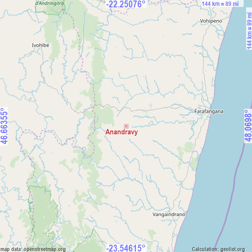
Anandravy GPS coordinates[2]
22° 54' 0" South, 47° 22' 0.012" East
| Map corner | latitude | longitude |
|---|---|---|
| Upper-left | -22.25076°, | 46.66355° |
| Center: | -22.9°, | 47.36667° |
| Lower-right: | -23.54615°, | 48.0698° |
| Map W x H: | 144×144 km | = 89.5×89.5mi |
| max Lat: | -12.31732° ⇑85.4% North |
| Anandravy: | -22.9° |
| min Lat: | ⇓14.6% South -25.3° |
| min Long | Anandravy | max Long |
| 43.65° | 47.36667° | 50.27876° |
| W 42.3%⇐ | ⇒57.7% E |
Elevation
Elevation of Anandravy is 169 m = 554 ft, and this is 388.4 m = 1274 ft below average elevation for this country.
| Max E: |
1763 m = 5784 ft | 56.1% |
| Avg. | 557.4 m = 1829 ft | |
| Anandravy | 169 m = 554 ft | |
Min E: |
1 m = 3 ft | 43.9% |
See also: Madagascar elevation on elevation.city.
Geographical zone
Anandravy is located in South Torrid zone (between Equator and Tropic of Capricorn). Distance of this Southern Tropic circle is 59.7 km =37.1 mi to South.| Distance of | km | miles | from Anandravy |
|---|---|---|---|
| Equator | 2546.2 | 1582.1 | to North |
| Tropic Capricorn | 59.7 | 37.1 | to South |
| Antarctic Circle | 4854.9 | 3016.7 | to South |
| South Pole | 7460.8 | 4635.9 | to South |


Nearby cities:
15 places around Anandravy: (largest is in red/bold)
• Ambalasoa
141.9 km =88.2 mi,  260°
260°
• Ambalavao
126.7 km =78.7 mi,  339°
339°
• Amboanjo
111.7 km =69.4 mi,  26°
26°
• Fandrandava
154.3 km =95.9 mi,  355°
355°
• Farafangana
47.9 km =29.8 mi,  79°
79°
• Ifatsy
68.1 km =42.3 mi,  35°
35°
• Ihosy
138.8 km =86.2 mi,  293°
293°
• Ikongo
113.3 km =70.4 mi,  3°
3°
• Manakara
106.6 km =66.2 mi, 38°
• Manato
56.9 km =35.4 mi,  12°
12°
• Savana
79.3 km =49.3 mi, 43°
• Vangaindrano
55.4 km =34.4 mi,  154°
154°
• Vohimanitra
137.8 km =85.6 mi, 14°
• Vohipaho
73.5 km =45.7 mi,  169°
169°
• Vondrozo
12.6 km =7.8 mi,  317°
317°
Sources, notices
• [Note1] Compared only with cities in Madagascar existing in our database
• [Src1] Map data: © OpenStreetMap contributors (CC-BY-SA)
• [Src2] Other city data from geonames.org with taken over terms of usage.
• [Src3] Geographical zone / Annual Mean Temperature by Robert A. Rohde @ Wikipedia
