Namdrik geodata
Namdrik (Namdrik Atoll) is a seat of a first-order administrative division; located in Marshall Islands in Pacific/Majuro (GMT+12) time zone. With population of 814 people, there are 6 cities with bigger population in this country. Compared to other cities in Marshall Islands, 95.8% of cities are located further ↑North; 70.8% of cities are located further →East and 58.3% of cities have higher elevation than Namdrik. Note1


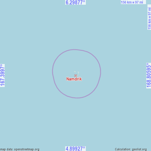
Namdrik GPS coordinates[2]
5° 35' 57.984" North, 168° 6' 10.152" East
| Map corner | latitude | longitude |
|---|---|---|
| Upper-left | 6.29877°, | 167.3997° |
| Center: | 5.59944°, | 168.10282° |
| Lower-right: | 4.89927°, | 168.80595° |
| Map W x H: | 155.6×155.6 km | = 96.7×96.7mi |
| max Lat: | 11.34735° ⇑95.8% North |
| Namdrik: | 5.59944° |
| min Lat: | ⇓4.2% South 4.58199° |
| min Long | Namdrik | max Long |
| 162.33733° | 168.10282° | 171.73502° |
| W 29.2%⇐ | ⇒70.8% E |
Elevation
Elevation of Namdrik is 9 m = 30 ft, and this is 0.7 m = 2 ft below average elevation for this country.
| Max E: |
16 m = 52 ft | 58.3% |
| Avg. | 9.7 m = 32 ft | |
| Namdrik | 9 m = 30 ft | |
Min E: |
5 m = 16 ft | 41.7% |
See also: Marshall Islands elevation on elevation.city.
Geographical zone
Namdrik is located in North Torrid zone (between Equator and Tropic of Cancer). Distance of Equator is 622.6 km =386.9 mi to South.| Distance of | km | miles | from Namdrik |
|---|---|---|---|
| North Pole | 9384.5 | 5831.3 | to North |
| Arctic Circle | 6778.6 | 4212 | to North |
| Tropic Cancer | 1983.3 | 1232.4 | to North |
| Equator | 622.6 | 386.9 | to South |


Nearby cities:
14 places around Namdrik: (largest is in red/bold)
• Airuk
202.7 km =126 mi,  23°
23°
• Arno
414.8 km =257.7 mi,  66°
66°
• Aur
441.5 km =274.3 mi,  50°
50°
• Ebaye
355.3 km =220.8 mi,  353°
353°
• Ebon
130.8 km =81.3 mi,  149°
149°
• Jabat
257.8 km =160.2 mi, 21°
• Jabor
174.1 km =108.2 mi,  78°
78°
• Kili
112.8 km =70.1 mi,  87°
87°
• Lae
421.5 km =261.9 mi,  331°
331°
• Lib
312.1 km =193.9 mi, 345°
• Loen
240.7 km =149.6 mi,  3°
3°
• Majuro
398.3 km =247.5 mi, 65°
• Mili
405.3 km =251.8 mi, 82°
• RMI Capitol
398.3 km =247.5 mi, 65°
Sources, notices
• [Note1] Compared only with cities in Marshall Islands existing in our database
• [Src1] Map data: © OpenStreetMap contributors (CC-BY-SA)
• [Src2] Other city data from geonames.org with taken over terms of usage.
• [Src3] Geographical zone / Annual Mean Temperature by Robert A. Rohde @ Wikipedia
