RMI Capitol geodata
RMI Capitol (Majuro Atoll) is a seat of government of a political entity; located in Marshall Islands in Pacific/Majuro (GMT+12) time zone. In our database, there are 20 cities with bigger population. Compared to other cities in Marshall Islands, 75% of cities are located further ↑North; 91.7% of cities are located further ←West and 83.3% of cities have higher elevation than RMI Capitol. Note1


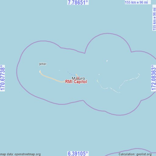
RMI Capitol GPS coordinates[2]
7° 5' 21.516" North, 171° 22' 49.8" East
| Map corner | latitude | longitude |
|---|---|---|
| Upper-left | 7.78651°, | 170.67738° |
| Center: | 7.08931°, | 171.3805° |
| Lower-right: | 6.39105°, | 172.08363° |
| Map W x H: | 155.2×155.2 km | = 96.4×96.4mi |
| max Lat: | 11.34735° ⇑75% North |
| RMI Capitol: | 7.08931° |
| min Lat: | ⇓25% South 4.58199° |
| min Long | RMI Capitol | max Long |
| 162.33733° | 171.3805° | 171.73502° |
| W 91.7%⇐ | ⇒8.3% E |
Elevation
Elevation of RMI Capitol is 7 m = 23 ft, and this is 2.7 m = 9 ft below average elevation for this country.
| Max E: |
16 m = 52 ft | 83.3% |
| Avg. | 9.7 m = 32 ft | |
| RMI Capitol | 7 m = 23 ft | |
Min E: |
5 m = 16 ft | 16.7% |
See also: Marshall Islands elevation on elevation.city.
Geographical zone
RMI Capitol is located in North Torrid zone (between Equator and Tropic of Cancer). Distance of Equator is 788.3 km =489.8 mi to South.| Distance of | km | miles | from RMI Capitol |
|---|---|---|---|
| North Pole | 9218.8 | 5728.3 | to North |
| Arctic Circle | 6612.9 | 4109.1 | to North |
| Tropic Cancer | 1817.7 | 1129.5 | to North |
| Equator | 788.3 | 489.8 | to South |


Nearby cities:
15 places around RMI Capitol: (largest is in red/bold)
• Ailuk
380.6 km =236.5 mi,  336°
336°
• Airuk
283.2 km =176 mi,  274°
274°
• Arno
19.3 km =12 mi,  97°
97°
• Aur
120.2 km =74.7 mi,  348°
348°
• Jabat
275.2 km =171 mi,  285°
285°
• Jabor
231.7 km =144 mi,  235°
235°
• Kili
296.9 km =184.5 mi, 237°
• Likiep
379.9 km =236.1 mi,  323°
323°
• Loen
355.2 km =220.7 mi,  282°
282°
• Majuro
0.1 km =0.1 mi,  330°
330°
• Mejit
358.8 km =222.9 mi, 350°
• Mili
118.7 km =73.8 mi,  160°
160°
• Namdrik
398.3 km =247.5 mi,  245°
245°
• Taroa
180.5 km =112.2 mi, 354°
• Wotje
291.5 km =181.1 mi, 334°
Sources, notices
• [Note1] Compared only with cities in Marshall Islands existing in our database
• [Src1] Map data: © OpenStreetMap contributors (CC-BY-SA)
• [Src2] Other city data from geonames.org with taken over terms of usage.
• [Src3] Geographical zone / Annual Mean Temperature by Robert A. Rohde @ Wikipedia
