Aur geodata
Aur (Aur Atoll) is a seat of a first-order administrative division; located in Marshall Islands in Pacific/Majuro (GMT+12) time zone. With population of 438 people, there are 12 cities with bigger population in this country. Compared to other cities in Marshall Islands, 54.2% of cities are located further ↑North; 79.2% of cities are located further ←West and 50% of cities have lower elevation than Aur. Note1


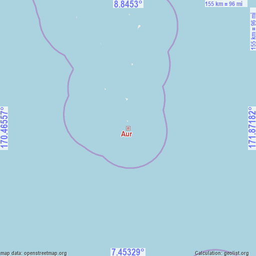
Aur GPS coordinates[2]
8° 8' 59.64" North, 171° 10' 7.284" East
| Map corner | latitude | longitude |
|---|---|---|
| Upper-left | 8.8453°, | 170.46557° |
| Center: | 8.1499°, | 171.16869° |
| Lower-right: | 7.45329°, | 171.87182° |
| Map W x H: | 154.8×154.8 km | = 96.2×96.2mi |
| max Lat: | 11.34735° ⇑54.2% North |
| Aur: | 8.1499° |
| min Lat: | ⇓45.8% South 4.58199° |
| min Long | Aur | max Long |
| 162.33733° | 171.16869° | 171.73502° |
| W 79.2%⇐ | ⇒20.8% E |
Elevation
Elevation of Aur is 10 m = 33 ft, and this is 0.3 m = 1 ft above average elevation for this country.
| Max E: |
16 m = 52 ft | 50% |
| Aur | 10 m 33 ft | |
| Avg. | 9.7 m = 32 ft | |
Min E: |
5 m = 16 ft | 50% |
See also: Marshall Islands elevation on elevation.city.
Geographical zone
Aur is located in North Torrid zone (between Equator and Tropic of Cancer). Distance of Equator is 906.2 km =563.1 mi to South.| Distance of | km | miles | from Aur |
|---|---|---|---|
| North Pole | 9100.9 | 5655 | to North |
| Arctic Circle | 6495 | 4035.8 | to North |
| Tropic Cancer | 1699.7 | 1056.1 | to North |
| Equator | 906.2 | 563.1 | to South |


Nearby cities:
15 places around Aur: (largest is in red/bold)
• Ailuk
264.6 km =164.4 mi,  330°
330°
• Airuk
276.3 km =171.7 mi,  249°
249°
• Arno
127.7 km =79.3 mi,  160°
160°
• Jabat
245.6 km =152.6 mi,  259°
259°
• Jabor
299.6 km =186.2 mi,  214°
214°
• Kili
358.8 km =222.9 mi,  219°
219°
• Likiep
276.3 km =171.7 mi,  312°
312°
• Loen
326.4 km =202.8 mi, 262°
• Majuro
120.2 km =74.7 mi,  168°
168°
• Mejit
238.7 km =148.3 mi,  351°
351°
• Mili
238.3 km =148.1 mi, 164°
• RMI Capitol
120.2 km =74.7 mi, 168°
• Taroa
62.1 km =38.6 mi,  5°
5°
• Utrik
371.6 km =230.9 mi,  337°
337°
• Wotje
177.5 km =110.3 mi,  324°
324°
Sources, notices
• [Note1] Compared only with cities in Marshall Islands existing in our database
• [Src1] Map data: © OpenStreetMap contributors (CC-BY-SA)
• [Src2] Other city data from geonames.org with taken over terms of usage.
• [Src3] Geographical zone / Annual Mean Temperature by Robert A. Rohde @ Wikipedia
