Kili geodata
Kili (Kili Island) is a seat of a first-order administrative division; located in Marshall Islands in Pacific/Majuro (GMT+12) time zone. With population of 602 people, there are 8 cities with bigger population in this country. Compared to other cities in Marshall Islands, 91.7% of cities are located further ↑North; 50% of cities are located further ←West and 95.8% of cities have higher elevation than Kili. Note1


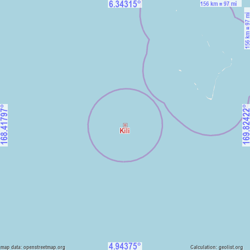
Kili GPS coordinates[2]
5° 38' 37.932" North, 169° 7' 15.924" East
| Map corner | latitude | longitude |
|---|---|---|
| Upper-left | 6.34315°, | 168.41797° |
| Center: | 5.64387°, | 169.12109° |
| Lower-right: | 4.94375°, | 169.82422° |
| Map W x H: | 155.6×155.6 km | = 96.7×96.7mi |
| max Lat: | 11.34735° ⇑91.7% North |
| Kili: | 5.64387° |
| min Lat: | ⇓8.3% South 4.58199° |
| min Long | Kili | max Long |
| 162.33733° | 169.12109° | 171.73502° |
| W 50%⇐ | ⇒50% E |
Elevation
Elevation of Kili is 6 m = 20 ft, and this is 3.7 m = 12 ft below average elevation for this country.
| Max E: |
16 m = 52 ft | 95.8% |
| Avg. | 9.7 m = 32 ft | |
| Kili | 6 m = 20 ft | |
Min E: |
5 m = 16 ft | 4.2% |
See also: Marshall Islands elevation on elevation.city.
Geographical zone
Kili is located in North Torrid zone (between Equator and Tropic of Cancer). Distance of Equator is 627.5 km =389.9 mi to South.| Distance of | km | miles | from Kili |
|---|---|---|---|
| North Pole | 9379.5 | 5828.1 | to North |
| Arctic Circle | 6773.6 | 4208.9 | to North |
| Tropic Cancer | 1978.4 | 1229.3 | to North |
| Equator | 627.5 | 389.9 | to South |


Nearby cities:
15 places around Kili: (largest is in red/bold)
• Airuk
184.6 km =114.7 mi,  349°
349°
• Arno
312 km =193.9 mi,  59°
59°
• Aur
358.8 km =222.9 mi,  39°
39°
• Ebaye
380 km =236.1 mi,  336°
336°
• Ebon
127.1 km =79 mi,  201°
201°
• Jabat
234.7 km =145.8 mi,  356°
356°
• Jabor
65.5 km =40.7 mi, 61°
• Lib
353.7 km =219.8 mi,  327°
327°
• Loen
255 km =158.4 mi, 337°
• Majuro
296.9 km =184.5 mi, 57°
• Mili
293.2 km =182.2 mi,  80°
80°
• Namdrik
112.8 km =70.1 mi,  267°
267°
• RMI Capitol
296.9 km =184.5 mi, 57°
• Taroa
412.2 km =256.1 mi,  34°
34°
• Wotje
441.2 km =274.1 mi,  16°
16°
Sources, notices
• [Note1] Compared only with cities in Marshall Islands existing in our database
• [Src1] Map data: © OpenStreetMap contributors (CC-BY-SA)
• [Src2] Other city data from geonames.org with taken over terms of usage.
• [Src3] Geographical zone / Annual Mean Temperature by Robert A. Rohde @ Wikipedia
