Jabor geodata
Jabor (Jaluit Atoll) is a seat of a first-order administrative division; located in Marshall Islands in Pacific/Majuro (GMT+12) time zone. With population of 1,200 people, there are 3 cities with bigger population in this country. Compared to other cities in Marshall Islands, 87.5% of cities are located further ↑North; 58.3% of cities are located further ←West and 100% of cities have higher elevation than Jabor. Note1


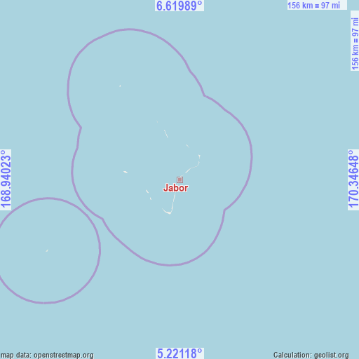
Jabor GPS coordinates[2]
5° 55' 15.528" North, 169° 38' 36.06" East
| Map corner | latitude | longitude |
|---|---|---|
| Upper-left | 6.61989°, | 168.94023° |
| Center: | 5.92098°, | 169.64335° |
| Lower-right: | 5.22118°, | 170.34648° |
| Map W x H: | 155.5×155.5 km | = 96.6×96.6mi |
| max Lat: | 11.34735° ⇑87.5% North |
| Jabor: | 5.92098° |
| min Lat: | ⇓12.5% South 4.58199° |
| min Long | Jabor | max Long |
| 162.33733° | 169.64335° | 171.73502° |
| W 58.3%⇐ | ⇒41.7% E |
Elevation
Elevation of Jabor is 5 m = 16 ft, and this is 4.7 m = 15 ft below average elevation for this country.
| Max E: |
16 m = 52 ft | 100% |
| Avg. | 9.7 m = 32 ft | |
| Jabor | 5 m = 16 ft | |
Min E: |
5 m = 16 ft | 0% |
See also: Marshall Islands elevation on elevation.city.
Geographical zone
Jabor is located in North Torrid zone (between Equator and Tropic of Cancer). Distance of Equator is 658.4 km =409.1 mi to South.| Distance of | km | miles | from Jabor |
|---|---|---|---|
| North Pole | 9348.7 | 5809 | to North |
| Arctic Circle | 6742.8 | 4189.8 | to North |
| Tropic Cancer | 1947.6 | 1210.2 | to North |
| Equator | 658.4 | 409.1 | to South |


Nearby cities:
15 places around Jabor: (largest is in red/bold)
• Airuk
176.1 km =109.4 mi,  328°
328°
• Arno
246.6 km =153.2 mi,  58°
58°
• Aur
299.6 km =186.2 mi,  34°
34°
• Ebaye
380.5 km =236.4 mi, 326°
• Ebon
182.1 km =113.2 mi,  215°
215°
• Jabat
216.3 km =134.4 mi,  340°
340°
• Kili
65.5 km =40.7 mi,  241°
241°
• Lib
365 km =226.8 mi,  316°
316°
• Loen
257.2 km =159.8 mi, 322°
• Majuro
231.7 km =144 mi, 55°
• Mili
232 km =144.2 mi,  85°
85°
• Namdrik
174.1 km =108.2 mi,  258°
258°
• RMI Capitol
231.7 km =144 mi, 55°
• Taroa
355.5 km =220.9 mi, 29°
• Wotje
398.3 km =247.5 mi,  9°
9°
Sources, notices
• [Note1] Compared only with cities in Marshall Islands existing in our database
• [Src1] Map data: © OpenStreetMap contributors (CC-BY-SA)
• [Src2] Other city data from geonames.org with taken over terms of usage.
• [Src3] Geographical zone / Annual Mean Temperature by Robert A. Rohde @ Wikipedia
