Niafunké geodata
Niafunké (Tombouctou) is a seat of a second-order administrative division; located in Mali in Africa/Bamako (GMT+0) time zone. With population of 6,901 people, there are 31 cities with bigger population in this country. Compared to other cities in Mali, 78.7% of cities are located further ↓South; 68.9% of cities are located further ←West and 75.4% of cities have higher elevation than Niafunké. Note1


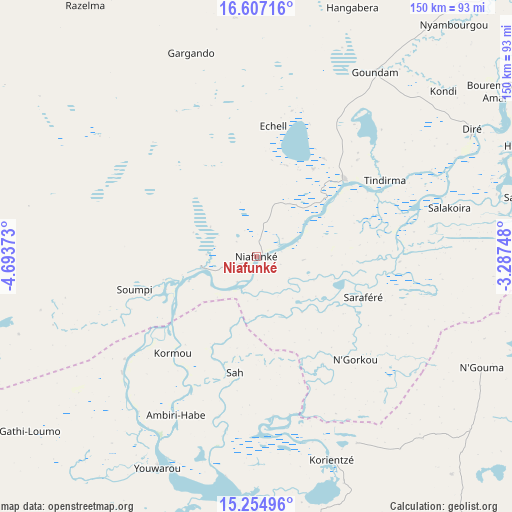
Niafunké GPS coordinates[2]
15° 55' 55.92" North, 3° 59' 26.16" West
| Map corner | latitude | longitude |
|---|---|---|
| Upper-left | 16.60716°, | -4.69373° |
| Center: | 15.9322°, | -3.9906° |
| Lower-right: | 15.25496°, | -3.28748° |
| Map W x H: | 150.4×150.4 km | = 93.5×93.5mi |
| max Lat: | 22.67443° ⇑21.3% North |
| Niafunké: | 15.9322° |
| min Lat: | ⇓78.7% South 10.55° |
| min Long | Niafunké | max Long |
| -11.44448° | -3.9906° | 3.14111° |
| W 68.9%⇐ | ⇒31.1% E |
Elevation
Elevation of Niafunké is 269 m = 883 ft, and this is 39 m = 128 ft below average elevation for this country.
| Max E: |
540 m = 1772 ft | 75.4% |
| Avg. | 308 m = 1010 ft | |
| Niafunké | 269 m = 883 ft | |
Min E: |
39 m = 128 ft | 24.6% |
See also: Mali elevation on elevation.city.
Geographical zone
Niafunké is located in North Torrid zone (between Equator and Tropic of Cancer). Distance of this Northern Tropic circle is 834.4 km =518.5 mi to North.| Distance of | km | miles | from Niafunké |
|---|---|---|---|
| North Pole | 8235.6 | 5117.4 | to North |
| Arctic Circle | 5629.7 | 3498.1 | to North |
| Tropic Cancer | 834.4 | 518.5 | to North |
| Equator | 1771.5 | 1100.8 | to South |


Nearby cities:
15 places around Niafunké: (largest is in red/bold)
• Bandiagara
180.6 km =112.2 mi,  166°
166°
• Bankass
212.4 km =132 mi, 166°
• Diré
72.6 km =45.1 mi,  60°
60°
• Djénné
233.3 km =145 mi,  195°
195°
• Douentza
152.1 km =94.5 mi,  132°
132°
• Goundam
63.6 km =39.5 mi,  32°
32°
• Gourma Rharous
244.3 km =151.8 mi, 64°
• Koro
229.8 km =142.8 mi,  154°
154°
• Ké-Macina
263.6 km =163.8 mi,  213°
213°
• Mopti
162.3 km =100.8 mi,  187°
187°
• Niono
284.8 km =177 mi,  229°
229°
• Sokolo
264.6 km =164.4 mi,  239°
239°
• Timbuktu
140.5 km =87.3 mi,  48°
48°
• Ténenkou
191.8 km =119.2 mi, 211°
• Youwarou
69.1 km =42.9 mi, 204°
Sources, notices
• [Note1] Compared only with cities in Mali existing in our database
• [Src1] Map data: © OpenStreetMap contributors (CC-BY-SA)
• [Src2] Other city data from geonames.org with taken over terms of usage.
• [Src3] Geographical zone / Annual Mean Temperature by Robert A. Rohde @ Wikipedia
