Nara geodata
Nara (Koulikoro) is a seat of a second-order administrative division; located in Mali in Africa/Bamako (GMT+0) time zone. In our database, there are 39 cities with bigger population. Compared to other cities in Mali, 70.5% of cities are located further ↓South; 70.5% of cities are located further →East and 80.3% of cities have higher elevation than Nara. Note1


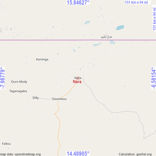
Nara GPS coordinates[2]
15° 10' 7.5" North, 7° 17' 4.776" West
| Map corner | latitude | longitude |
|---|---|---|
| Upper-left | 15.84627°, | -7.98779° |
| Center: | 15.16875°, | -7.28466° |
| Lower-right: | 14.48905°, | -6.58154° |
| Map W x H: | 150.9×150.9 km | = 93.8×93.8mi |
| max Lat: | 22.67443° ⇑29.5% North |
| Nara: | 15.16875° |
| min Lat: | ⇓70.5% South 10.55° |
| min Long | Nara | max Long |
| -11.44448° | -7.28466° | 3.14111° |
| W 29.5%⇐ | ⇒70.5% E |
Elevation
Elevation of Nara is 264 m = 866 ft, and this is 44 m = 144 ft below average elevation for this country.
| Max E: |
540 m = 1772 ft | 80.3% |
| Avg. | 308 m = 1010 ft | |
| Nara | 264 m = 866 ft | |
Min E: |
39 m = 128 ft | 19.7% |
See also: Mali elevation on elevation.city.
Geographical zone
Nara is located in North Torrid zone (between Equator and Tropic of Cancer). Distance of this Northern Tropic circle is 919.3 km =571.2 mi to North.| Distance of | km | miles | from Nara |
|---|---|---|---|
| North Pole | 8320.5 | 5170.1 | to North |
| Arctic Circle | 5714.6 | 3550.9 | to North |
| Tropic Cancer | 919.3 | 571.2 | to North |
| Equator | 1686.6 | 1048 | to South |


Nearby cities:
15 places around Nara: (largest is in red/bold)
• Bamako
290.5 km =180.5 mi,  195°
195°
• Banamba
181.1 km =112.5 mi,  185°
185°
• Barouéli
237.7 km =147.7 mi,  168°
168°
• Diéma
216.6 km =134.6 mi,  251°
251°
• Kati
282.7 km =175.7 mi, 197°
• Kolokani
194.9 km =121.1 mi, 204°
• Koulikoro
258.1 km =160.4 mi, 186°
• Ké-Macina
246.8 km =153.4 mi,  122°
122°
• Markala
209.3 km =130.1 mi,  141°
141°
• Niono
172.3 km =107.1 mi,  126°
126°
• Nioro
247.8 km =154 mi,  271°
271°
• Sokolo
134 km =83.3 mi,  111°
111°
• Ségou
224.9 km =139.7 mi,  149°
149°
• Séguéla
131.8 km =81.9 mi, 153°
• Ténenkou
266.5 km =165.6 mi, 107°
Sources, notices
• [Note1] Compared only with cities in Mali existing in our database
• [Src1] Map data: © OpenStreetMap contributors (CC-BY-SA)
• [Src2] Other city data from geonames.org with taken over terms of usage.
• [Src3] Geographical zone / Annual Mean Temperature by Robert A. Rohde @ Wikipedia
