Kati geodata
Kati (Koulikoro) is a seat of a second-order administrative division; located in Mali in Africa/Bamako (GMT+0) time zone. With population of 42,922 people, there are 9 cities with bigger population in this country. Compared to other cities in Mali, 75.4% of cities are located further ↑North; 80.3% of cities are located further →East and 91.8% of cities have lower elevation than Kati. Note1


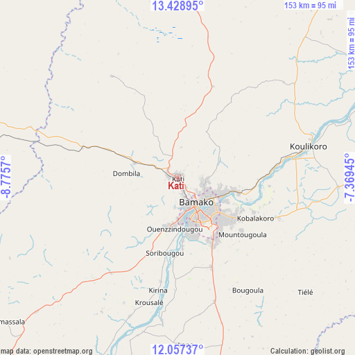
Kati GPS coordinates[2]
12° 44' 38.724" North, 8° 4' 21.252" West
| Map corner | latitude | longitude |
|---|---|---|
| Upper-left | 13.42895°, | -8.7757° |
| Center: | 12.74409°, | -8.07257° |
| Lower-right: | 12.05737°, | -7.36945° |
| Map W x H: | 152.5×152.5 km | = 94.8×94.8mi |
| max Lat: | 22.67443° ⇑75.4% North |
| Kati: | 12.74409° |
| min Lat: | ⇓24.6% South 10.55° |
| min Long | Kati | max Long |
| -11.44448° | -8.07257° | 3.14111° |
| W 19.7%⇐ | ⇒80.3% E |
Elevation
Elevation of Kati is 423 m = 1388 ft, and this is 115 m = 377 ft above average elevation for this country.
| Max E: |
540 m = 1772 ft | 8.2% |
| Kati | 423 m 1388 ft | |
| Avg. | 308 m = 1010 ft | |
Min E: |
39 m = 128 ft | 91.8% |
See also: Kati elevation on elevation.city.
Geographical zone
Kati is located in North Torrid zone (between Equator and Tropic of Cancer). Distance of this Northern Tropic circle is 1188.9 km =738.7 mi to North.| Distance of | km | miles | from Kati |
|---|---|---|---|
| North Pole | 8590.1 | 5337.6 | to North |
| Arctic Circle | 5984.2 | 3718.4 | to North |
| Tropic Cancer | 1188.9 | 738.7 | to North |
| Equator | 1417 | 880.5 | to South |


Nearby cities:
15 places around Kati: (largest is in red/bold)
• Bamako
13.1 km =8.1 mi,  143°
143°
• Banamba
112.1 km =69.7 mi,  37°
37°
• Barouéli
139.5 km =86.7 mi,  74°
74°
• Bougouni
160.8 km =99.9 mi,  156°
156°
• Dioila
142.1 km =88.3 mi,  101°
101°
• Figuira-Toma
97.4 km =60.5 mi,  199°
199°
• Kangaba
97.6 km =60.6 mi, 202°
• Kita
156.9 km =97.5 mi,  281°
281°
• Kokofata
204.1 km =126.8 mi,  274°
274°
• Kolokani
92.2 km =57.3 mi,  2°
2°
• Kolondiéba
224.3 km =139.4 mi,  145°
145°
• Koulikoro
57.1 km =35.5 mi,  76°
76°
• Ségou
215.1 km =133.7 mi, 69°
• Séguéla
210.4 km =130.7 mi, 43°
• Yanfolila
173.7 km =107.9 mi,  182°
182°
Sources, notices
• [Note1] Compared only with cities in Mali existing in our database
• [Src1] Map data: © OpenStreetMap contributors (CC-BY-SA)
• [Src2] Other city data from geonames.org with taken over terms of usage.
• [Src3] Geographical zone / Annual Mean Temperature by Robert A. Rohde @ Wikipedia
