Kokofata geodata
Kokofata (Kayes) is a populated place; located in Mali in Africa/Bamako (GMT+0) time zone. With population of 12,985 people, there are 20 cities with bigger population in this country. Compared to other cities in Mali, 70.5% of cities are located further ↑North; 91.8% of cities are located further →East and 50.8% of cities have lower elevation than Kokofata. Note1


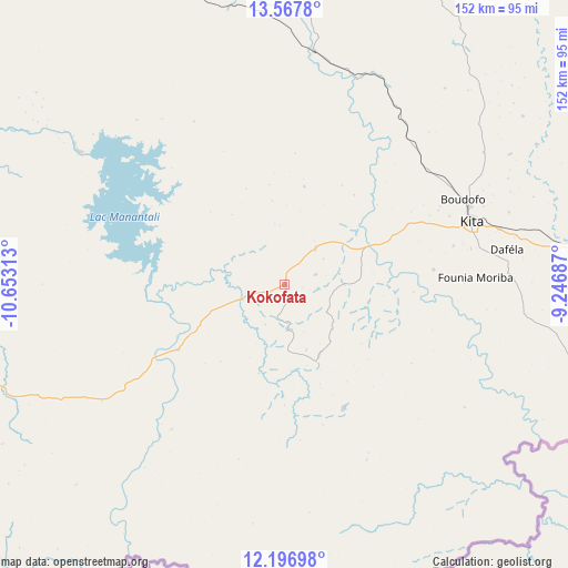
Kokofata GPS coordinates[2]
12° 52' 59.988" North, 9° 57' 0" West
| Map corner | latitude | longitude |
|---|---|---|
| Upper-left | 13.5678°, | -10.65313° |
| Center: | 12.88333°, | -9.95° |
| Lower-right: | 12.19698°, | -9.24687° |
| Map W x H: | 152.4×152.4 km | = 94.7×94.7mi |
| max Lat: | 22.67443° ⇑70.5% North |
| Kokofata: | 12.88333° |
| min Lat: | ⇓29.5% South 10.55° |
| min Long | Kokofata | max Long |
| -11.44448° | -9.95° | 3.14111° |
| W 8.2%⇐ | ⇒91.8% E |
Elevation
Elevation of Kokofata is 295 m = 968 ft, and this is 13 m = 43 ft below average elevation for this country.
| Max E: |
540 m = 1772 ft | 49.2% |
| Avg. | 308 m = 1010 ft | |
| Kokofata | 295 m = 968 ft | |
Min E: |
39 m = 128 ft | 50.8% |
See also: Mali elevation on elevation.city.
Geographical zone
Kokofata is located in North Torrid zone (between Equator and Tropic of Cancer). Distance of this Northern Tropic circle is 1173.4 km =729.1 mi to North.| Distance of | km | miles | from Kokofata |
|---|---|---|---|
| North Pole | 8574.6 | 5328 | to North |
| Arctic Circle | 5968.7 | 3708.8 | to North |
| Tropic Cancer | 1173.4 | 729.1 | to North |
| Equator | 1432.5 | 890.1 | to South |


Nearby cities:
15 places around Kokofata: (largest is in red/bold)
• Bafoulabé
140.2 km =87.1 mi,  317°
317°
• Bamako
213 km =132.4 mi,  96°
96°
• Diré
128.9 km =80.1 mi,  238°
238°
• Diéma
201.6 km =125.3 mi,  23°
23°
• Figuira-Toma
202.8 km =126 mi,  122°
122°
• Kangaba
197.2 km =122.5 mi, 122°
• Kati
204.1 km =126.8 mi,  94°
94°
• Kayes
237.3 km =147.5 mi, 317°
• Kita
52.7 km =32.7 mi,  71°
71°
• Kolokani
221.1 km =137.4 mi, 69°
• Koulikoro
259.1 km =161 mi, 90°
• Nioro
263.7 km =163.9 mi,  8°
8°
• Sagalo
111.4 km =69.2 mi,  226°
226°
• Yanfolila
272.1 km =169.1 mi,  134°
134°
• Yélimané
257.6 km =160.1 mi,  344°
344°
Sources, notices
• [Note1] Compared only with cities in Mali existing in our database
• [Src1] Map data: © OpenStreetMap contributors (CC-BY-SA)
• [Src2] Other city data from geonames.org with taken over terms of usage.
• [Src3] Geographical zone / Annual Mean Temperature by Robert A. Rohde @ Wikipedia
