Kangaba geodata
Kangaba (Koulikoro) is a seat of a second-order administrative division; located in Mali in Africa/Bamako (GMT+0) time zone. With population of 17,232 people, there are 18 cities with bigger population in this country. Compared to other cities in Mali, 90.2% of cities are located further ↑North; 85.2% of cities are located further →East and 75.4% of cities have lower elevation than Kangaba. Note1


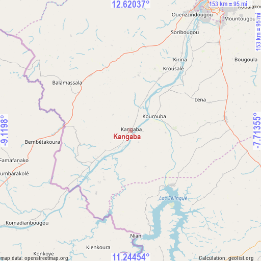
Kangaba GPS coordinates[2]
11° 55' 59.988" North, 8° 25' 0.012" West
| Map corner | latitude | longitude |
|---|---|---|
| Upper-left | 12.62037°, | -9.1198° |
| Center: | 11.93333°, | -8.41667° |
| Lower-right: | 11.24454°, | -7.71355° |
| Map W x H: | 153×153 km | = 95.1×95.1mi |
| max Lat: | 22.67443° ⇑90.2% North |
| Kangaba: | 11.93333° |
| min Lat: | ⇓9.8% South 10.55° |
| min Long | Kangaba | max Long |
| -11.44448° | -8.41667° | 3.14111° |
| W 14.8%⇐ | ⇒85.2% E |
Elevation
Elevation of Kangaba is 343 m = 1125 ft, and this is 35 m = 115 ft above average elevation for this country.
| Max E: |
540 m = 1772 ft | 24.6% |
| Kangaba | 343 m 1125 ft | |
| Avg. | 308 m = 1010 ft | |
Min E: |
39 m = 128 ft | 75.4% |
See also: Mali elevation on elevation.city.
Geographical zone
Kangaba is located in North Torrid zone (between Equator and Tropic of Cancer). Distance of this Northern Tropic circle is 1279.1 km =794.8 mi to North.| Distance of | km | miles | from Kangaba |
|---|---|---|---|
| North Pole | 8680.2 | 5393.6 | to North |
| Arctic Circle | 6074.3 | 3774.4 | to North |
| Tropic Cancer | 1279.1 | 794.8 | to North |
| Equator | 1326.9 | 824.5 | to South |


Nearby cities:
15 places around Kangaba: (largest is in red/bold)
• Bamako
91.6 km =56.9 mi,  29°
29°
• Banamba
208 km =129.2 mi, 30°
• Barouéli
214 km =133 mi,  53°
53°
• Bougouni
116.7 km =72.5 mi,  119°
119°
• Dioila
186.9 km =116.1 mi,  70°
70°
• Diré
279.9 km =173.9 mi,  277°
277°
• Figuira-Toma
5.7 km =3.5 mi,  108°
108°
• Kati
97.6 km =60.6 mi,  22°
22°
• Kita
169 km =105 mi,  316°
316°
• Kokofata
197.2 km =122.5 mi,  302°
302°
• Kolokani
187 km =116.2 mi,  12°
12°
• Kolondiéba
190.7 km =118.5 mi, 119°
• Koulikoro
139.1 km =86.4 mi,  41°
41°
• Sagalo
250 km =155.3 mi, 276°
• Yanfolila
88.3 km =54.9 mi,  160°
160°
Sources, notices
• [Note1] Compared only with cities in Mali existing in our database
• [Src1] Map data: © OpenStreetMap contributors (CC-BY-SA)
• [Src2] Other city data from geonames.org with taken over terms of usage.
• [Src3] Geographical zone / Annual Mean Temperature by Robert A. Rohde @ Wikipedia
