Myitkyina geodata
Myitkyina (Kachin) is a seat of a first-order administrative division; located in Myanmar in Asia/Yangon (GMT+6.5) time zone. With population of 90,894 people, there are 25 cities with bigger population in this country. Compared to other cities in Myanmar, 100% of cities are located further ↓South; 75.7% of cities are located further ←West and 82.4% of cities have lower elevation than Myitkyina. Note1


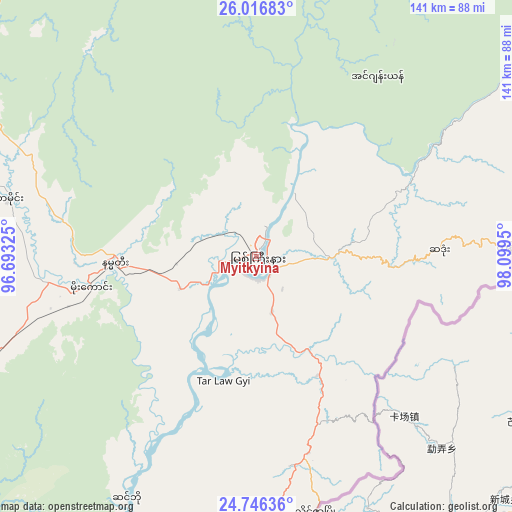
Myitkyina GPS coordinates[2]
25° 22' 59.772" North, 97° 23' 46.932" East
| Map corner | latitude | longitude |
|---|---|---|
| Upper-left | 26.01683°, | 96.69325° |
| Center: | 25.38327°, | 97.39637° |
| Lower-right: | 24.74636°, | 98.0995° |
| Map W x H: | 141.3×141.3 km | = 87.8×87.8mi |
| max Lat: | 25.38327° ⇑0% North |
| Myitkyina: | 25.38327° |
| min Lat: | ⇓100% South 9.98238° |
| min Long | Myitkyina | max Long |
| 92.89835° | 97.39637° | 99.88083° |
| W 75.7%⇐ | ⇒24.3% E |
Elevation
Elevation of Myitkyina is 147 m = 482 ft, and this is 41.9 m = 137 ft below average elevation for this country.
| Max E: |
1768 m = 5801 ft | 17.6% |
| Avg. | 188.9 m = 620 ft | |
| Myitkyina | 147 m = 482 ft | |
Min E: |
5 m = 16 ft | 82.4% |
See also: Myitkyina elevation on elevation.city.
Geographical zone
Myitkyina is located in North temperate zone (between Tropic of Cancer and the Arctic Circle). Distance of this Northern Tropic circle is 216.4 km =134.5 mi to South.| Distance of | km | miles | from Myitkyina |
|---|---|---|---|
| North Pole | 7184.7 | 4464.4 | to North |
| Arctic Circle | 4578.8 | 2845.1 | to North |
| Tropic Cancer | 216.4 | 134.5 | to South |
| Equator | 2822.4 | 1753.8 | to South |


Nearby cities:
10 places around Myitkyina: (largest is in red/bold)
• Bhamo
126.8 km =78.8 mi,  187°
187°
• Kyaukse
439.3 km =273 mi,  197°
197°
• Lashio
274.5 km =170.6 mi,  172°
172°
• Mandalay
401.9 km =249.7 mi, 199°
• Mawlaik
359.2 km =223.2 mi,  237°
237°
• Mogok
288.5 km =179.3 mi, 198°
• Monywa
430.7 km =267.6 mi,  212°
212°
• Pyin Oo Lwin
384.4 km =238.9 mi, 194°
• Sagaing
415.5 km =258.2 mi, 200°
• Shwebo
357.3 km =222 mi, 208°
Sources, notices
• [Note1] Compared only with cities in Myanmar existing in our database
• [Src1] Map data: © OpenStreetMap contributors (CC-BY-SA)
• [Src2] Other city data from geonames.org with taken over terms of usage.
• [Src3] Geographical zone / Annual Mean Temperature by Robert A. Rohde @ Wikipedia
