Mawlaik geodata
Mawlaik (Sagain) is a populated place; located in Myanmar in Asia/Yangon (GMT+6.5) time zone. With population of 44,540 people, there are 54 cities with bigger population in this country. Compared to other cities in Myanmar, 97.3% of cities are located further ↓South; 95.9% of cities are located further →East and 79.7% of cities have lower elevation than Mawlaik. Note1


Mawlaik GPS coordinates[2]
23° 38' 33.144" North, 94° 24' 17.208" East
| Map corner | latitude | longitude |
|---|---|---|
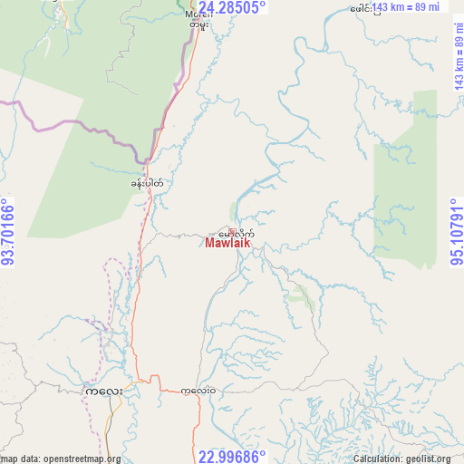
| Upper-left | 24.28505°, | 93.70166° |
| Center: | 23.64254°, | 94.40478° |
| Lower-right: | 22.99686°, | 95.10791° |
| Map W x H: | 143.2×143.2 km | = 89×89mi |
| max Lat: | 25.38327° ⇑2.7% North |
| Mawlaik: | 23.64254° |
| min Lat: | ⇓97.3% South 9.98238° |
| min Long | Mawlaik | max Long |
| 92.89835° | 94.40478° | 99.88083° |
| W 4.1%⇐ | ⇒95.9% E |
Elevation
Elevation of Mawlaik is 129 m = 423 ft, and this is 59.9 m = 197 ft below average elevation for this country.
| Max E: |
1768 m = 5801 ft | 20.3% |
| Avg. | 188.9 m = 620 ft | |
| Mawlaik | 129 m = 423 ft | |
Min E: |
5 m = 16 ft | 79.7% |
See also: Mawlaik elevation on elevation.city.
Geographical zone
Mawlaik is located in North temperate zone (between Tropic of Cancer and the Arctic Circle). Distance of this Northern Tropic circle is 22.9 km =14.2 mi to South.| Distance of | km | miles | from Mawlaik |
|---|---|---|---|
| North Pole | 7378.3 | 4584.7 | to North |
| Arctic Circle | 4772.4 | 2965.4 | to North |
| Tropic Cancer | 22.9 | 14.2 | to South |
| Equator | 2628.8 | 1633.5 | to South |


Nearby cities:
15 places around Mawlaik: (largest is in red/bold)
• Bhamo
295.3 km =183.5 mi,  76°
76°
• Chauk
308 km =191.4 mi,  172°
172°
• Falam
109.9 km =68.3 mi,  222°
222°
• Hakha
137.5 km =85.4 mi, 216°
• Kyaukse
287.8 km =178.8 mi,  141°
141°
• Lashio
350.5 km =217.8 mi,  102°
102°
• Mandalay
253 km =157.2 mi, 137°
• Meiktila
341.9 km =212.4 mi,  154°
154°
• Mogok
229.6 km =142.7 mi,  110°
110°
• Monywa
186.3 km =115.8 mi,  156°
156°
• Myingyan
262.9 km =163.4 mi, 157°
• Pakokku
265.9 km =165.2 mi, 164°
• Pyin Oo Lwin
276 km =171.5 mi,  130°
130°
• Sagaing
254 km =157.8 mi, 140°
• Shwebo
178.2 km =110.7 mi, 132°
Sources, notices
• [Note1] Compared only with cities in Myanmar existing in our database
• [Src1] Map data: © OpenStreetMap contributors (CC-BY-SA)
• [Src2] Other city data from geonames.org with taken over terms of usage.
• [Src3] Geographical zone / Annual Mean Temperature by Robert A. Rohde @ Wikipedia
