Sagaing geodata
Sagaing (Sagain) is a seat of a first-order administrative division; located in Myanmar in Asia/Yangon (GMT+6.5) time zone. With population of 78,739 people, there are 31 cities with bigger population in this country. Compared to other cities in Myanmar, 85.1% of cities are located further ↓South; 58.1% of cities are located further →East and 67.6% of cities have lower elevation than Sagaing. Note1


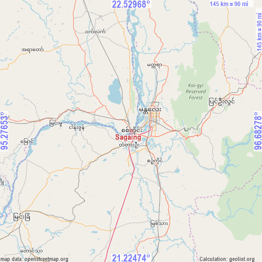
Sagaing GPS coordinates[2]
21° 52' 43.32" North, 95° 58' 46.74" East
| Map corner | latitude | longitude |
|---|---|---|
| Upper-left | 22.52968°, | 95.27653° |
| Center: | 21.8787°, | 95.97965° |
| Lower-right: | 21.22474°, | 96.68278° |
| Map W x H: | 145.1×145.1 km | = 90.2×90.2mi |
| max Lat: | 25.38327° ⇑14.9% North |
| Sagaing: | 21.8787° |
| min Lat: | ⇓85.1% South 9.98238° |
| min Long | Sagaing | max Long |
| 92.89835° | 95.97965° | 99.88083° |
| W 41.9%⇐ | ⇒58.1% E |
Elevation
Elevation of Sagaing is 75 m = 246 ft, and this is 113.9 m = 374 ft below average elevation for this country.
| Max E: |
1768 m = 5801 ft | 32.4% |
| Avg. | 188.9 m = 620 ft | |
| Sagaing | 75 m = 246 ft | |
Min E: |
5 m = 16 ft | 67.6% |
See also: Sagaing elevation on elevation.city.
Geographical zone
Sagaing is located in North Torrid zone (between Equator and Tropic of Cancer). Distance of this Northern Tropic circle is 173.2 km =107.6 mi to North.| Distance of | km | miles | from Sagaing |
|---|---|---|---|
| North Pole | 7574.4 | 4706.5 | to North |
| Arctic Circle | 4968.5 | 3087.3 | to North |
| Tropic Cancer | 173.2 | 107.6 | to North |
| Equator | 2432.7 | 1511.6 | to South |


Nearby cities:
15 places around Sagaing: (largest is in red/bold)
• Chauk
162.3 km =100.8 mi,  227°
227°
• Indein
181.2 km =112.6 mi,  150°
150°
• Kyaukse
34.3 km =21.3 mi, 152°
• Mandalay
15.1 km =9.4 mi,  45°
45°
• Meiktila
112 km =69.6 mi,  186°
186°
• Mogok
127.7 km =79.3 mi,  25°
25°
• Monywa
90.7 km =56.4 mi,  286°
286°
• Myingyan
76.8 km =47.7 mi, 232°
• Nyaungshwe
167.7 km =104.2 mi,  143°
143°
• Pakokku
110.6 km =68.7 mi,  236°
236°
• Pyin Oo Lwin
52.2 km =32.4 mi,  70°
70°
• Shwebo
82.1 km =51 mi,  339°
339°
• Taunggyi
163.4 km =101.5 mi, 137°
• Yamethin
161.7 km =100.5 mi,  174°
174°
• Yenangyaung
194.7 km =121 mi,  216°
216°
Sources, notices
• [Note1] Compared only with cities in Myanmar existing in our database
• [Src1] Map data: © OpenStreetMap contributors (CC-BY-SA)
• [Src2] Other city data from geonames.org with taken over terms of usage.
• [Src3] Geographical zone / Annual Mean Temperature by Robert A. Rohde @ Wikipedia
