Pathein geodata
Pathein (Ayeyarwady) is a seat of a first-order administrative division; located in Myanmar in Asia/Yangon (GMT+6.5) time zone. With population of 237,089 people, there are 6 cities with bigger population in this country. Compared to other cities in Myanmar, 66.2% of cities are located further ↑North; 94.6% of cities are located further →East and 98.6% of cities have higher elevation than Pathein. Note1


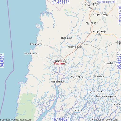
Pathein GPS coordinates[2]
16° 46' 45.084" North, 94° 43' 55.632" East
| Map corner | latitude | longitude |
|---|---|---|
| Upper-left | 17.45117°, | 94.029° |
| Center: | 16.77919°, | 94.73212° |
| Lower-right: | 16.10482°, | 95.43525° |
| Map W x H: | 149.7×149.7 km | = 93×93mi |
| max Lat: | 25.38327° ⇑66.2% North |
| Pathein: | 16.77919° |
| min Lat: | ⇓33.8% South 9.98238° |
| min Long | Pathein | max Long |
| 92.89835° | 94.73212° | 99.88083° |
| W 5.4%⇐ | ⇒94.6% E |
Elevation
Elevation of Pathein is 8 m = 26 ft, and this is 180.9 m = 594 ft below average elevation for this country.
| Max E: |
1768 m = 5801 ft | 98.6% |
| Avg. | 188.9 m = 620 ft | |
| Pathein | 8 m = 26 ft | |
Min E: |
5 m = 16 ft | 1.4% |
See also: Pathein elevation on elevation.city.
Geographical zone
Pathein is located in North Torrid zone (between Equator and Tropic of Cancer). Distance of this Northern Tropic circle is 740.2 km =459.9 mi to North.| Distance of | km | miles | from Pathein |
|---|---|---|---|
| North Pole | 8141.4 | 5058.8 | to North |
| Arctic Circle | 5535.5 | 3439.6 | to North |
| Tropic Cancer | 740.2 | 459.9 | to North |
| Equator | 1865.7 | 1159.3 | to South |


Nearby cities:
15 places around Pathein: (largest is in red/bold)
• Bogale
89.1 km =55.4 mi,  127°
127°
• Hinthada
123.7 km =76.9 mi,  38°
38°
• Kanbe
135.4 km =84.1 mi,  93°
93°
• Kyaiklat
112 km =69.6 mi,  109°
109°
• Letpandan
155.7 km =96.7 mi, 43°
• Maubin
98.3 km =61.1 mi, 93°
• Mawlamyinegyunn
72.3 km =44.9 mi, 128°
• Myanaung
178.8 km =111.1 mi,  20°
20°
• Nyaungdon
100.9 km =62.7 mi,  73°
73°
• Pyapon
114.9 km =71.4 mi,  118°
118°
• Syriam
161.1 km =100.1 mi, 90°
• Tharyarwady
148.5 km =92.3 mi,  49°
49°
• Twante
127.6 km =79.3 mi, 93°
• Wakema
51.8 km =32.2 mi, 112°
• Yangon
151.6 km =94.2 mi, 88°
Sources, notices
• [Note1] Compared only with cities in Myanmar existing in our database
• [Src1] Map data: © OpenStreetMap contributors (CC-BY-SA)
• [Src2] Other city data from geonames.org with taken over terms of usage.
• [Src3] Geographical zone / Annual Mean Temperature by Robert A. Rohde @ Wikipedia
