Myanaung geodata
Myanaung (Ayeyarwady) is a populated place; located in Myanmar in Asia/Yangon (GMT+6.5) time zone. With population of 42,252 people, there are 56 cities with bigger population in this country. Compared to other cities in Myanmar, 51.4% of cities are located further ↓South; 78.4% of cities are located further →East and 58.1% of cities have higher elevation than Myanaung. Note1


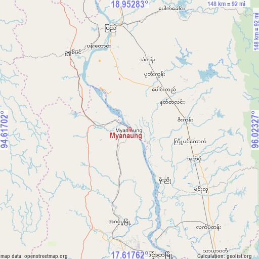
Myanaung GPS coordinates[2]
18° 17' 11.436" North, 95° 19' 12.504" East
| Map corner | latitude | longitude |
|---|---|---|
| Upper-left | 18.95283°, | 94.61702° |
| Center: | 18.28651°, | 95.32014° |
| Lower-right: | 17.61762°, | 96.02327° |
| Map W x H: | 148.5×148.5 km | = 92.3×92.3mi |
| max Lat: | 25.38327° ⇑48.6% North |
| Myanaung: | 18.28651° |
| min Lat: | ⇓51.4% South 9.98238° |
| min Long | Myanaung | max Long |
| 92.89835° | 95.32014° | 99.88083° |
| W 21.6%⇐ | ⇒78.4% E |
Elevation
Elevation of Myanaung is 26 m = 85 ft, and this is 162.9 m = 534 ft below average elevation for this country.
| Max E: |
1768 m = 5801 ft | 58.1% |
| Avg. | 188.9 m = 620 ft | |
| Myanaung | 26 m = 85 ft | |
Min E: |
5 m = 16 ft | 41.9% |
See also: Myanaung elevation on elevation.city.
Geographical zone
Myanaung is located in North Torrid zone (between Equator and Tropic of Cancer). Distance of this Northern Tropic circle is 572.6 km =355.8 mi to North.| Distance of | km | miles | from Myanaung |
|---|---|---|---|
| North Pole | 7973.8 | 4954.7 | to North |
| Arctic Circle | 5367.9 | 3335.5 | to North |
| Tropic Cancer | 572.6 | 355.8 | to North |
| Equator | 2033.3 | 1263.4 | to South |


Nearby cities:
15 places around Myanaung: (largest is in red/bold)
• Bago
162.2 km =100.8 mi,  130°
130°
• Hinthada
72.3 km =44.9 mi,  168°
168°
• Letpandan
71.8 km =44.6 mi,  140°
140°
• Maubin
176.5 km =109.7 mi, 168°
• Myaydo
120.8 km =75.1 mi,  354°
354°
• Nyaungdon
142.2 km =88.4 mi, 166°
• Nyaunglebin
152.7 km =94.9 mi,  104°
104°
• Pathein
178.8 km =111.1 mi,  200°
200°
• Paungde
30.1 km =18.7 mi,  40°
40°
• Pyay
60.7 km =37.7 mi, 350°
• Pyu
119.9 km =74.5 mi,  79°
79°
• Taungoo
138.2 km =85.9 mi,  58°
58°
• Thanatpin
172.9 km =107.4 mi, 129°
• Tharyarwady
86 km =53.4 mi, 144°
• Thayetmyo
115.9 km =72 mi, 352°
Sources, notices
• [Note1] Compared only with cities in Myanmar existing in our database
• [Src1] Map data: © OpenStreetMap contributors (CC-BY-SA)
• [Src2] Other city data from geonames.org with taken over terms of usage.
• [Src3] Geographical zone / Annual Mean Temperature by Robert A. Rohde @ Wikipedia
