Letpandan geodata
Letpandan (Bago) is a populated place; located in Myanmar in Asia/Yangon (GMT+6.5) time zone. With population of 38,936 people, there are 61 cities with bigger population in this country. Compared to other cities in Myanmar, 51.4% of cities are located further ↑North; 63.5% of cities are located further →East and 63.5% of cities have higher elevation than Letpandan. Note1


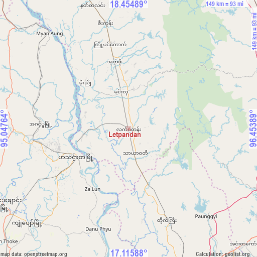
Letpandan GPS coordinates[2]
17° 47' 11.904" North, 95° 45' 2.736" East
| Map corner | latitude | longitude |
|---|---|---|
| Upper-left | 18.45489°, | 95.04764° |
| Center: | 17.78664°, | 95.75076° |
| Lower-right: | 17.11588°, | 96.45389° |
| Map W x H: | 148.9×148.9 km | = 92.5×92.5mi |
| max Lat: | 25.38327° ⇑51.4% North |
| Letpandan: | 17.78664° |
| min Lat: | ⇓48.6% South 9.98238° |
| min Long | Letpandan | max Long |
| 92.89835° | 95.75076° | 99.88083° |
| W 36.5%⇐ | ⇒63.5% E |
Elevation
Elevation of Letpandan is 23 m = 75 ft, and this is 165.9 m = 544 ft below average elevation for this country.
| Max E: |
1768 m = 5801 ft | 63.5% |
| Avg. | 188.9 m = 620 ft | |
| Letpandan | 23 m = 75 ft | |
Min E: |
5 m = 16 ft | 36.5% |
See also: Myanmar elevation on elevation.city.
Geographical zone
Letpandan is located in North Torrid zone (between Equator and Tropic of Cancer). Distance of this Northern Tropic circle is 628.2 km =390.3 mi to North.| Distance of | km | miles | from Letpandan |
|---|---|---|---|
| North Pole | 8029.4 | 4989.2 | to North |
| Arctic Circle | 5423.5 | 3370 | to North |
| Tropic Cancer | 628.2 | 390.3 | to North |
| Equator | 1977.7 | 1228.9 | to South |


Nearby cities:
15 places around Letpandan: (largest is in red/bold)
• Bago
92.3 km =57.4 mi,  122°
122°
• Hinthada
34.6 km =21.5 mi,  243°
243°
• Kanbe
122.9 km =76.4 mi,  167°
167°
• Maubin
117.8 km =73.2 mi,  184°
184°
• Myanaung
71.8 km =44.6 mi,  320°
320°
• Nyaungdon
83.3 km =51.8 mi,  188°
188°
• Nyaunglebin
104.5 km =64.9 mi,  79°
79°
• Paungde
82.6 km =51.3 mi,  341°
341°
• Pyay
128.2 km =79.7 mi,  334°
334°
• Pyu
106 km =65.9 mi,  43°
43°
• Syriam
124.7 km =77.5 mi,  155°
155°
• Thanatpin
103.3 km =64.2 mi, 122°
• Tharyarwady
15.3 km =9.5 mi, 164°
• Twante
121.1 km =75.2 mi, 171°
• Yangon
117.3 km =72.9 mi, 158°
Sources, notices
• [Note1] Compared only with cities in Myanmar existing in our database
• [Src1] Map data: © OpenStreetMap contributors (CC-BY-SA)
• [Src2] Other city data from geonames.org with taken over terms of usage.
• [Src3] Geographical zone / Annual Mean Temperature by Robert A. Rohde @ Wikipedia
