Bayan-Ovoo geodata
Bayan-Ovoo (Hentiy) is a seat of a second-order administrative division; located in Mongolia in Asia/Ulaanbaatar (GMT+8) time zone. In our database, there are 33 cities with bigger population. Compared to other cities in Mongolia, 77% of cities are located further ↓South; 91.1% of cities are located further ←West and 87.1% of cities have higher elevation than Bayan-Ovoo. Note1


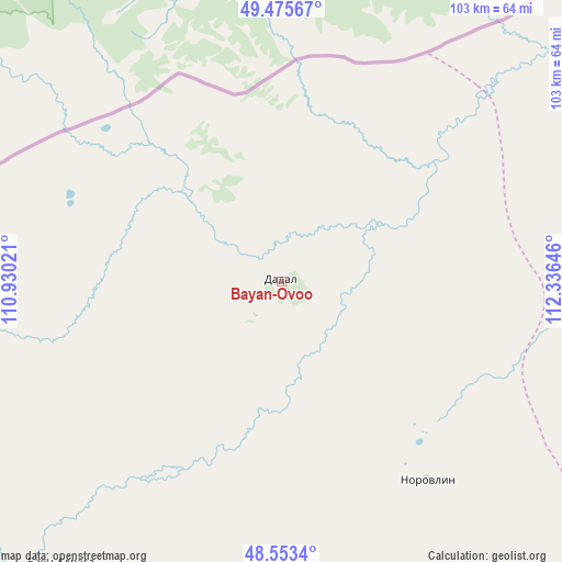
Bayan-Ovoo GPS coordinates[2]
49° 1' 0.012" North, 111° 37' 59.988" East
| Map corner | latitude | longitude |
|---|---|---|
| Upper-left | 49.47567°, | 110.93021° |
| Center: | 49.01667°, | 111.63333° |
| Lower-right: | 48.5534°, | 112.33646° |
| Map W x H: | 102.5×102.5 km | = 63.7×63.7mi |
| max Lat: | 51.50725° ⇑23% North |
| Bayan-Ovoo: | 49.01667° |
| min Lat: | ⇓77% South 42.84199° |
| min Long | Bayan-Ovoo | max Long |
| 89.14358° | 111.63333° | 118.51014° |
| W 91.1%⇐ | ⇒8.9% E |
Elevation
Elevation of Bayan-Ovoo is 957 m = 3140 ft, and this is 459.5 m = 1508 ft below average elevation for this country.
| Max E: |
2800 m = 9186 ft | 87.1% |
| Avg. | 1416.5 m = 4647 ft | |
| Bayan-Ovoo | 957 m = 3140 ft | |
Min E: |
619 m = 2031 ft | 12.9% |
See also: Mongolia elevation on elevation.city.
Geographical zone
Bayan-Ovoo is located in North temperate zone (between Tropic of Cancer and the Arctic Circle). Distance of this North polar circle is 1951 km =1212.3 mi to North.| Distance of | km | miles | from Bayan-Ovoo |
|---|---|---|---|
| North Pole | 4556.9 | 2831.5 | to North |
| Arctic Circle | 1951 | 1212.3 | to North |
| Tropic Cancer | 2844.2 | 1767.3 | to South |
| Equator | 5450.1 | 3386.5 | to South |


Nearby cities:
15 places around Bayan-Ovoo: (largest is in red/bold)
• Bayan
65.7 km =40.8 mi,  217°
217°
• Bayan
156.1 km =97 mi,  141°
141°
• Bayanbulag
179.9 km =111.8 mi, 224°
• Dundbürd
119.5 km =74.3 mi,  184°
184°
• Eg
112.4 km =69.8 mi,  250°
250°
• Hanhöhiy
160 km =99.4 mi,  166°
166°
• Javarthushuu
81.5 km =50.6 mi,  79°
79°
• Javhlant
141.7 km =88 mi, 165°
• Naranbulag
129.1 km =80.2 mi, 78°
• Onon
87.8 km =54.6 mi,  239°
239°
• Sergelen
186.3 km =115.8 mi,  105°
105°
• Tsagaan-Owoo
148.8 km =92.5 mi,  117°
117°
• Uldz
44.9 km =27.9 mi, 143°
• Undurkhaan
202.2 km =125.6 mi,  201°
201°
• Öndörhoshuu
203.7 km =126.6 mi, 123°
Sources, notices
• [Note1] Compared only with cities in Mongolia existing in our database
• [Src1] Map data: © OpenStreetMap contributors (CC-BY-SA)
• [Src2] Other city data from geonames.org with taken over terms of usage.
• [Src3] Geographical zone / Annual Mean Temperature by Robert A. Rohde @ Wikipedia
