Onon geodata
Onon (Hentiy) is a seat of a second-order administrative division; located in Mongolia in Asia/Ulaanbaatar (GMT+8) time zone. In our database, there are 33 cities with bigger population. Compared to other cities in Mongolia, 69.3% of cities are located further ↓South; 88.3% of cities are located further ←West and 79.1% of cities have higher elevation than Onon. Note1


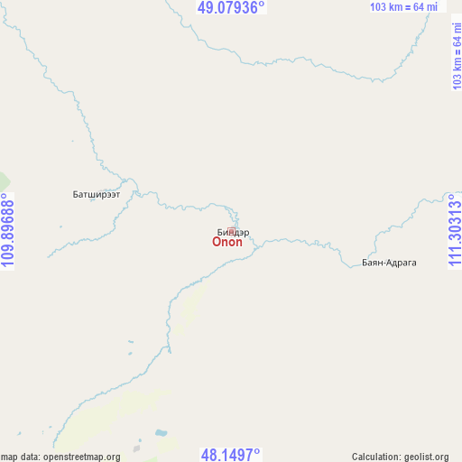
Onon GPS coordinates[2]
48° 37' 0.012" North, 110° 36' 0" East
| Map corner | latitude | longitude |
|---|---|---|
| Upper-left | 49.07936°, | 109.89688° |
| Center: | 48.61667°, | 110.6° |
| Lower-right: | 48.1497°, | 111.30313° |
| Map W x H: | 103.4×103.4 km | = 64.2×64.2mi |
| max Lat: | 51.50725° ⇑30.7% North |
| Onon: | 48.61667° |
| min Lat: | ⇓69.3% South 42.84199° |
| min Long | Onon | max Long |
| 89.14358° | 110.6° | 118.51014° |
| W 88.3%⇐ | ⇒11.7% E |
Elevation
Elevation of Onon is 1053 m = 3455 ft, and this is 363.5 m = 1193 ft below average elevation for this country.
| Max E: |
2800 m = 9186 ft | 79.1% |
| Avg. | 1416.5 m = 4647 ft | |
| Onon | 1053 m = 3455 ft | |
Min E: |
619 m = 2031 ft | 20.9% |
See also: Mongolia elevation on elevation.city.
Geographical zone
Onon is located in North temperate zone (between Tropic of Cancer and the Arctic Circle). Distance of this North polar circle is 1995.5 km =1239.9 mi to North.| Distance of | km | miles | from Onon |
|---|---|---|---|
| North Pole | 4601.4 | 2859.2 | to North |
| Arctic Circle | 1995.5 | 1239.9 | to North |
| Tropic Cancer | 2799.7 | 1739.7 | to South |
| Equator | 5405.7 | 3358.9 | to South |


Nearby cities:
15 places around Onon: (largest is in red/bold)
• Bayan
36.3 km =22.6 mi,  101°
101°
• Bayan
162 km =100.7 mi,  174°
174°
• Bayan-Ovoo
87.8 km =54.6 mi,  59°
59°
• Bayanbulag
97.5 km =60.6 mi,  211°
211°
• Bulag
162.9 km =101.2 mi,  253°
253°
• Dundbürd
99.9 km =62.1 mi,  138°
138°
• Eg
31.5 km =19.6 mi,  283°
283°
• Hanhöhiy
159.1 km =98.9 mi,  134°
134°
• Herlen
146.4 km =91 mi,  180°
180°
• Javarthushuu
166.9 km =103.7 mi,  69°
69°
• Javhlant
145.7 km =90.5 mi, 129°
• Modot
150 km =93.2 mi,  230°
230°
• Mörön
138.8 km =86.2 mi,  188°
188°
• Uldz
102.8 km =63.9 mi,  85°
85°
• Undurkhaan
144.3 km =89.7 mi, 178°
Sources, notices
• [Note1] Compared only with cities in Mongolia existing in our database
• [Src1] Map data: © OpenStreetMap contributors (CC-BY-SA)
• [Src2] Other city data from geonames.org with taken over terms of usage.
• [Src3] Geographical zone / Annual Mean Temperature by Robert A. Rohde @ Wikipedia
