Huurch geodata
Huurch (Selenge) is a seat of a second-order administrative division; located in Mongolia in Asia/Ulaanbaatar (GMT+8) time zone. In our database, there are 33 cities with bigger population. Compared to other cities in Mongolia, 95.4% of cities are located further ↓South; 66.3% of cities are located further ←West and 94.2% of cities have higher elevation than Huurch. Note1


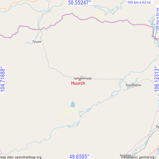
Huurch GPS coordinates[2]
50° 6' 12.996" North, 105° 25' 12" East
| Map corner | latitude | longitude |
|---|---|---|
| Upper-left | 50.55247°, | 104.71688° |
| Center: | 50.10361°, | 105.42° |
| Lower-right: | 49.6505°, | 106.12313° |
| Map W x H: | 100.3×100.3 km | = 62.3×62.3mi |
| max Lat: | 51.50725° ⇑4.6% North |
| Huurch: | 50.10361° |
| min Lat: | ⇓95.4% South 42.84199° |
| min Long | Huurch | max Long |
| 89.14358° | 105.42° | 118.51014° |
| W 66.3%⇐ | ⇒33.7% E |
Elevation
Elevation of Huurch is 765 m = 2510 ft, and this is 651.5 m = 2137 ft below average elevation for this country.
| Max E: |
2800 m = 9186 ft | 94.2% |
| Avg. | 1416.5 m = 4647 ft | |
| Huurch | 765 m = 2510 ft | |
Min E: |
619 m = 2031 ft | 5.8% |
See also: Mongolia elevation on elevation.city.
Geographical zone
Huurch is located in North temperate zone (between Tropic of Cancer and the Arctic Circle). Distance of this North polar circle is 1830.2 km =1137.2 mi to North.| Distance of | km | miles | from Huurch |
|---|---|---|---|
| North Pole | 4436.1 | 2756.5 | to North |
| Arctic Circle | 1830.2 | 1137.2 | to North |
| Tropic Cancer | 2965.1 | 1842.4 | to South |
| Equator | 5571 | 3461.7 | to South |


Nearby cities:
15 places around Huurch: (largest is in red/bold)
• Altanbulag
80.3 km =49.9 mi,  72°
72°
• Bugant
117.7 km =73.1 mi,  119°
119°
• Burgaltay
105.2 km =65.4 mi,  207°
207°
• Darhan
77.5 km =48.2 mi,  152°
152°
• Delgerhaan
54.7 km =34 mi,  92°
92°
• Dzelter
35.6 km =22.1 mi,  311°
311°
• Enhtal
95.2 km =59.2 mi,  182°
182°
• Hongor
103 km =64 mi,  160°
160°
• Hushaat
68.6 km =42.6 mi,  168°
168°
• Jargalant
33.1 km =20.6 mi,  96°
96°
• Nart
106.6 km =66.2 mi, 181°
• Nomgon
102 km =63.4 mi, 170°
• Orhon
59.4 km =36.9 mi, 120°
• Sört
114.9 km =71.4 mi,  220°
220°
• Sühbaatar
57.9 km =36 mi,  75°
75°
Sources, notices
• [Note1] Compared only with cities in Mongolia existing in our database
• [Src1] Map data: © OpenStreetMap contributors (CC-BY-SA)
• [Src2] Other city data from geonames.org with taken over terms of usage.
• [Src3] Geographical zone / Annual Mean Temperature by Robert A. Rohde @ Wikipedia
