Bugant geodata
Bugant (Selenge) is a seat of a second-order administrative division; located in Mongolia in Asia/Ulaanbaatar (GMT+8) time zone. In our database, there are 33 cities with bigger population. Compared to other cities in Mongolia, 88.7% of cities are located further ↓South; 76.1% of cities are located further ←West and 93.6% of cities have higher elevation than Bugant. Note1


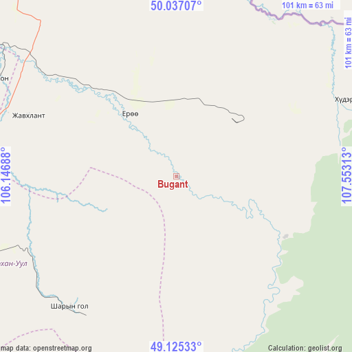
Bugant GPS coordinates[2]
49° 34' 59.988" North, 106° 51' 0" East
| Map corner | latitude | longitude |
|---|---|---|
| Upper-left | 50.03707°, | 106.14688° |
| Center: | 49.58333°, | 106.85° |
| Lower-right: | 49.12533°, | 107.55313° |
| Map W x H: | 101.4×101.4 km | = 63×63mi |
| max Lat: | 51.50725° ⇑11.3% North |
| Bugant: | 49.58333° |
| min Lat: | ⇓88.7% South 42.84199° |
| min Long | Bugant | max Long |
| 89.14358° | 106.85° | 118.51014° |
| W 76.1%⇐ | ⇒23.9% E |
Elevation
Elevation of Bugant is 766 m = 2513 ft, and this is 650.5 m = 2134 ft below average elevation for this country.
| Max E: |
2800 m = 9186 ft | 93.6% |
| Avg. | 1416.5 m = 4647 ft | |
| Bugant | 766 m = 2513 ft | |
Min E: |
619 m = 2031 ft | 6.4% |
See also: Mongolia elevation on elevation.city.
Geographical zone
Bugant is located in North temperate zone (between Tropic of Cancer and the Arctic Circle). Distance of this North polar circle is 1888 km =1173.1 mi to North.| Distance of | km | miles | from Bugant |
|---|---|---|---|
| North Pole | 4493.9 | 2792.4 | to North |
| Arctic Circle | 1888 | 1173.1 | to North |
| Tropic Cancer | 2907.2 | 1806.4 | to South |
| Equator | 5513.1 | 3425.7 | to South |


Nearby cities:
15 places around Bugant: (largest is in red/bold)
• Altanbulag
85.2 km =52.9 mi,  342°
342°
• Bulagtay
52.5 km =32.6 mi,  65°
65°
• Darhan
67.8 km =42.1 mi,  260°
260°
• Delgerhaan
73.4 km =45.6 mi,  319°
319°
• Dzüünharaa
86.1 km =53.5 mi,  199°
199°
• Dzüünkharaa
106 km =65.9 mi,  184°
184°
• Enhtal
113.1 km =70.3 mi,  250°
250°
• Hongor
79.4 km =49.3 mi,  240°
240°
• Hushaat
89.5 km =55.6 mi, 264°
• Jargalant
87.9 km =54.6 mi,  307°
307°
• Javhlant
109.9 km =68.3 mi,  217°
217°
• Nomgon
95.7 km =59.5 mi, 243°
• Orhon
58.3 km =36.2 mi,  298°
298°
• Sharïngol
49 km =30.4 mi, 218°
• Sühbaatar
85.5 km =53.1 mi,  327°
327°
Sources, notices
• [Note1] Compared only with cities in Mongolia existing in our database
• [Src1] Map data: © OpenStreetMap contributors (CC-BY-SA)
• [Src2] Other city data from geonames.org with taken over terms of usage.
• [Src3] Geographical zone / Annual Mean Temperature by Robert A. Rohde @ Wikipedia
