Bayasgalant geodata
Bayasgalant (Sühbaatar) is a seat of a second-order administrative division; located in Mongolia in Asia/Choibalsan (GMT+8) time zone. In our database, there are 33 cities with bigger population. Compared to other cities in Mongolia, 61% of cities are located further ↑North; 92% of cities are located further ←West and 64.7% of cities have higher elevation than Bayasgalant. Note1


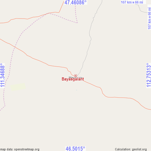
Bayasgalant GPS coordinates[2]
46° 58' 59.988" North, 112° 3' 0" East
| Map corner | latitude | longitude |
|---|---|---|
| Upper-left | 47.46086°, | 111.34688° |
| Center: | 46.98333°, | 112.05° |
| Lower-right: | 46.5015°, | 112.75313° |
| Map W x H: | 106.7×106.7 km | = 66.3×66.3mi |
| max Lat: | 51.50725° ⇑61% North |
| Bayasgalant: | 46.98333° |
| min Lat: | ⇓39% South 42.84199° |
| min Long | Bayasgalant | max Long |
| 89.14358° | 112.05° | 118.51014° |
| W 92%⇐ | ⇒8% E |
Elevation
Elevation of Bayasgalant is 1242 m = 4075 ft, and this is 174.5 m = 573 ft below average elevation for this country.
| Max E: |
2800 m = 9186 ft | 64.7% |
| Avg. | 1416.5 m = 4647 ft | |
| Bayasgalant | 1242 m = 4075 ft | |
Min E: |
619 m = 2031 ft | 35.3% |
See also: Mongolia elevation on elevation.city.
Geographical zone
Bayasgalant is located in North temperate zone (between Tropic of Cancer and the Arctic Circle). Distance of this North polar circle is 2177.1 km =1352.8 mi to North.| Distance of | km | miles | from Bayasgalant |
|---|---|---|---|
| North Pole | 4783 | 2972 | to North |
| Arctic Circle | 2177.1 | 1352.8 | to North |
| Tropic Cancer | 2618.1 | 1626.8 | to South |
| Equator | 5224.1 | 3246.1 | to South |


Nearby cities:
15 places around Bayasgalant: (largest is in red/bold)
• Baruun-Urt
99.4 km =61.8 mi,  109°
109°
• Bayan
95.6 km =59.4 mi,  282°
282°
• Bayan
123.9 km =77 mi,  33°
33°
• Buyant
123.6 km =76.8 mi,  228°
228°
• Dundbürd
114.8 km =71.3 mi,  338°
338°
• Dzüünbulag
67.5 km =41.9 mi,  171°
171°
• Hanhöhiy
70.7 km =43.9 mi,  5°
5°
• Hatavch
113.9 km =70.8 mi,  142°
142°
• Haylaastay
141.3 km =87.8 mi,  99°
99°
• Herlen
117.6 km =73.1 mi,  287°
287°
• Javhlant
89.1 km =55.4 mi,  3°
3°
• Mörön
138.3 km =85.9 mi, 288°
• Sergelen
88.9 km =55.2 mi,  191°
191°
• Ulaandel
135.3 km =84.1 mi,  120°
120°
• Undurkhaan
111.9 km =69.5 mi, 289°
Sources, notices
• [Note1] Compared only with cities in Mongolia existing in our database
• [Src1] Map data: © OpenStreetMap contributors (CC-BY-SA)
• [Src2] Other city data from geonames.org with taken over terms of usage.
• [Src3] Geographical zone / Annual Mean Temperature by Robert A. Rohde @ Wikipedia
