Havirga geodata
Havirga (Sühbaatar) is a seat of a second-order administrative division; located in Mongolia in Asia/Choibalsan (GMT+8) time zone. In our database, there are 33 cities with bigger population. Compared to other cities in Mongolia, 84.4% of cities are located further ↑North; 94.5% of cities are located further ←West and 77% of cities have higher elevation than Havirga. Note1


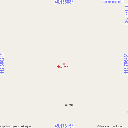
Havirga GPS coordinates[2]
45° 40' 0.012" North, 113° 4' 59.988" East
| Map corner | latitude | longitude |
|---|---|---|
| Upper-left | 46.15588°, | 112.38021° |
| Center: | 45.66667°, | 113.08333° |
| Lower-right: | 45.17315°, | 113.78646° |
| Map W x H: | 109.3×109.3 km | = 67.9×67.9mi |
| max Lat: | 51.50725° ⇑84.4% North |
| Havirga: | 45.66667° |
| min Lat: | ⇓15.6% South 42.84199° |
| min Long | Havirga | max Long |
| 89.14358° | 113.08333° | 118.51014° |
| W 94.5%⇐ | ⇒5.5% E |
Elevation
Elevation of Havirga is 1090 m = 3576 ft, and this is 326.5 m = 1071 ft below average elevation for this country.
| Max E: |
2800 m = 9186 ft | 77% |
| Avg. | 1416.5 m = 4647 ft | |
| Havirga | 1090 m = 3576 ft | |
Min E: |
619 m = 2031 ft | 23% |
See also: Mongolia elevation on elevation.city.
Geographical zone
Havirga is located in North temperate zone (between Tropic of Cancer and the Arctic Circle). Distance of this North polar circle is 2323.5 km =1443.8 mi to North.| Distance of | km | miles | from Havirga |
|---|---|---|---|
| North Pole | 4929.4 | 3063 | to North |
| Arctic Circle | 2323.5 | 1443.8 | to North |
| Tropic Cancer | 2471.7 | 1535.8 | to South |
| Equator | 5077.7 | 3155.1 | to South |


Nearby cities:
15 places around Havirga: (largest is in red/bold)
• Baruun-Urt
113.7 km =70.6 mi,  7°
7°
• Bayasgalant
166.5 km =103.5 mi,  331°
331°
• Buyant
185.6 km =115.3 mi,  290°
290°
• Chandmanĭ
204.1 km =126.8 mi,  265°
265°
• Chonogol
178.9 km =111.2 mi,  81°
81°
• Dzüünbulag
105.7 km =65.7 mi,  318°
318°
• Hatavch
56.5 km =35.1 mi,  349°
349°
• Haylaastay
137.3 km =85.3 mi,  26°
26°
• Hongor
75.4 km =46.9 mi,  141°
141°
• Hongor
146.9 km =91.3 mi,  275°
275°
• Ovoot
72.1 km =44.8 mi,  123°
123°
• Sergelen
114.5 km =71.1 mi,  301°
301°
• Shireet
56.9 km =35.4 mi, 276°
• Ulaan-Uul
207.7 km =129.1 mi,  224°
224°
• Ulaandel
86.4 km =53.7 mi, 26°
Sources, notices
• [Note1] Compared only with cities in Mongolia existing in our database
• [Src1] Map data: © OpenStreetMap contributors (CC-BY-SA)
• [Src2] Other city data from geonames.org with taken over terms of usage.
• [Src3] Geographical zone / Annual Mean Temperature by Robert A. Rohde @ Wikipedia
