Sergelen geodata
Sergelen (Sühbaatar) is a seat of a second-order administrative division; located in Mongolia in Asia/Choibalsan (GMT+8) time zone. In our database, there are 33 cities with bigger population. Compared to other cities in Mongolia, 76.1% of cities are located further ↑North; 91.4% of cities are located further ←West and 75.5% of cities have higher elevation than Sergelen. Note1


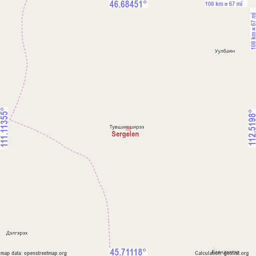
Sergelen GPS coordinates[2]
46° 12' 0" North, 111° 49' 0.012" East
| Map corner | latitude | longitude |
|---|---|---|
| Upper-left | 46.68451°, | 111.11355° |
| Center: | 46.2°, | 111.81667° |
| Lower-right: | 45.71118°, | 112.5198° |
| Map W x H: | 108.2×108.2 km | = 67.2×67.2mi |
| max Lat: | 51.50725° ⇑76.1% North |
| Sergelen: | 46.2° |
| min Lat: | ⇓23.9% South 42.84199° |
| min Long | Sergelen | max Long |
| 89.14358° | 111.81667° | 118.51014° |
| W 91.4%⇐ | ⇒8.6% E |
Elevation
Elevation of Sergelen is 1102 m = 3615 ft, and this is 314.5 m = 1032 ft below average elevation for this country.
| Max E: |
2800 m = 9186 ft | 75.5% |
| Avg. | 1416.5 m = 4647 ft | |
| Sergelen | 1102 m = 3615 ft | |
Min E: |
619 m = 2031 ft | 24.5% |
See also: Mongolia elevation on elevation.city.
Geographical zone
Sergelen is located in North temperate zone (between Tropic of Cancer and the Arctic Circle). Distance of this North polar circle is 2264.2 km =1406.9 mi to North.| Distance of | km | miles | from Sergelen |
|---|---|---|---|
| North Pole | 4870.1 | 3026.1 | to North |
| Arctic Circle | 2264.2 | 1406.9 | to North |
| Tropic Cancer | 2531 | 1572.7 | to South |
| Equator | 5137 | 3192 | to South |


Nearby cities:
15 places around Sergelen: (largest is in red/bold)
• Baruun-Urt
124.1 km =77.1 mi,  64°
64°
• Bayan
127 km =78.9 mi,  272°
272°
• Bayan
131.8 km =81.9 mi,  324°
324°
• Bayasgalant
88.9 km =55.2 mi,  11°
11°
• Buyant
75.8 km =47.1 mi, 274°
• Chandmanĭ
128.1 km =79.6 mi,  234°
234°
• Dzüünbulag
34.8 km =21.6 mi,  54°
54°
• Hanhöhiy
159.3 km =99 mi, 8°
• Hatavch
87.3 km =54.2 mi,  92°
92°
• Havirga
114.5 km =71.1 mi,  121°
121°
• Herlen
155 km =96.3 mi, 322°
• Hongor
65.2 km =40.5 mi, 226°
• Shireet
67.1 km =41.7 mi,  141°
141°
• Ulaandel
136.5 km =84.8 mi,  82°
82°
• Undurkhaan
152.7 km =94.9 mi, 324°
Sources, notices
• [Note1] Compared only with cities in Mongolia existing in our database
• [Src1] Map data: © OpenStreetMap contributors (CC-BY-SA)
• [Src2] Other city data from geonames.org with taken over terms of usage.
• [Src3] Geographical zone / Annual Mean Temperature by Robert A. Rohde @ Wikipedia
