Bulgan geodata
Bulgan (Hövsgöl) is a seat of a second-order administrative division; located in Mongolia in Asia/Ulaanbaatar (GMT+8) time zone. In our database, there are 33 cities with bigger population. Compared to other cities in Mongolia, 98.5% of cities are located further ↓South; 56.4% of cities are located further →East and 73.3% of cities have higher elevation than Bulgan. Note1


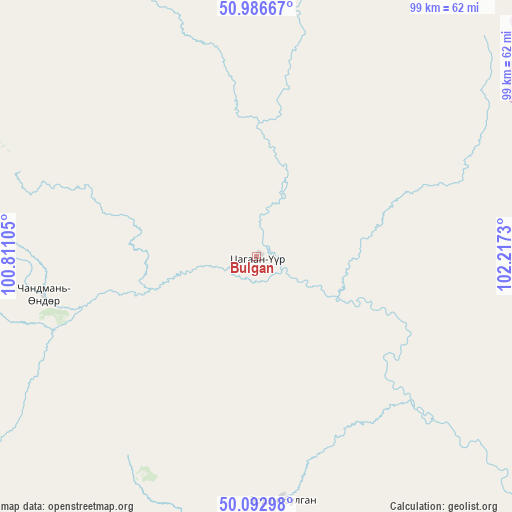
Bulgan GPS coordinates[2]
50° 32' 30.984" North, 101° 30' 51.012" East
| Map corner | latitude | longitude |
|---|---|---|
| Upper-left | 50.98667°, | 100.81105° |
| Center: | 50.54194°, | 101.51417° |
| Lower-right: | 50.09298°, | 102.2173° |
| Map W x H: | 99.4×99.4 km | = 61.8×61.8mi |
| max Lat: | 51.50725° ⇑1.5% North |
| Bulgan: | 50.54194° |
| min Lat: | ⇓98.5% South 42.84199° |
| min Long | Bulgan | max Long |
| 89.14358° | 101.51417° | 118.51014° |
| W 43.6%⇐ | ⇒56.4% E |
Elevation
Elevation of Bulgan is 1129 m = 3704 ft, and this is 287.5 m = 943 ft below average elevation for this country.
| Max E: |
2800 m = 9186 ft | 73.3% |
| Avg. | 1416.5 m = 4647 ft | |
| Bulgan | 1129 m = 3704 ft | |
Min E: |
619 m = 2031 ft | 26.7% |
See also: Mongolia elevation on elevation.city.
Geographical zone
Bulgan is located in North temperate zone (between Tropic of Cancer and the Arctic Circle). Distance of this North polar circle is 1781.4 km =1106.9 mi to North.| Distance of | km | miles | from Bulgan |
|---|---|---|---|
| North Pole | 4387.3 | 2726.1 | to North |
| Arctic Circle | 1781.4 | 1106.9 | to North |
| Tropic Cancer | 3013.8 | 1872.7 | to South |
| Equator | 5619.7 | 3491.9 | to South |


Nearby cities:
15 places around Bulgan: (largest is in red/bold)
• Badrah
108.2 km =67.2 mi,  161°
161°
• Bulag
98.7 km =61.3 mi,  219°
219°
• Dzöölön
143.8 km =89.4 mi,  295°
295°
• Eg-Uur
48.3 km =30 mi,  174°
174°
• Hutag
152.9 km =95 mi,  146°
146°
• Mandal
164.3 km =102.1 mi,  244°
244°
• Manhan
114.4 km =71.1 mi,  245°
245°
• Murun-kuren
139.6 km =86.7 mi, 223°
• Rashaant
157.5 km =97.9 mi,  182°
182°
• Selenge
123.3 km =76.6 mi, 181°
• Teshig
105 km =65.2 mi,  129°
129°
• Tsengel
126.4 km =78.5 mi,  200°
200°
• Turt
122.7 km =76.2 mi,  330°
330°
• Undur Sume
42.2 km =26.2 mi,  259°
259°
• Vlaa Vula
161.7 km =100.5 mi,  275°
275°
Sources, notices
• [Note1] Compared only with cities in Mongolia existing in our database
• [Src1] Map data: © OpenStreetMap contributors (CC-BY-SA)
• [Src2] Other city data from geonames.org with taken over terms of usage.
• [Src3] Geographical zone / Annual Mean Temperature by Robert A. Rohde @ Wikipedia
