Vlaa Vula geodata
Vlaa Vula (Hövsgöl) is a seat of a second-order administrative division; located in Mongolia in Asia/Ulaanbaatar (GMT+8) time zone. In our database, there are 33 cities with bigger population. Compared to other cities in Mongolia, 99.1% of cities are located further ↓South; 69.9% of cities are located further →East and 73.9% of cities have lower elevation than Vlaa Vula. Note1


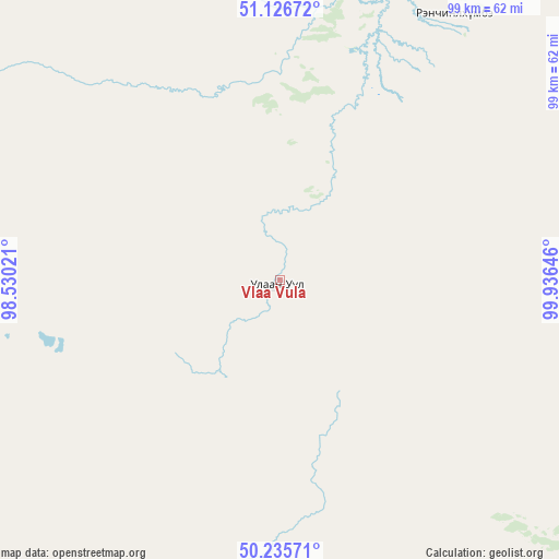
Vlaa Vula GPS coordinates[2]
50° 40' 59.988" North, 99° 13' 59.988" East
| Map corner | latitude | longitude |
|---|---|---|
| Upper-left | 51.12672°, | 98.53021° |
| Center: | 50.68333°, | 99.23333° |
| Lower-right: | 50.23571°, | 99.93646° |
| Map W x H: | 99.1×99.1 km | = 61.6×61.6mi |
| max Lat: | 51.50725° ⇑0.9% North |
| Vlaa Vula: | 50.68333° |
| min Lat: | ⇓99.1% South 42.84199° |
| min Long | Vlaa Vula | max Long |
| 89.14358° | 99.23333° | 118.51014° |
| W 30.1%⇐ | ⇒69.9% E |
Elevation
Elevation of Vlaa Vula is 1682 m = 5518 ft, and this is 265.5 m = 871 ft above average elevation for this country.
| Max E: |
2800 m = 9186 ft | 26.1% |
| Vlaa Vula | 1682 m 5518 ft | |
| Avg. | 1416.5 m = 4647 ft | |
Min E: |
619 m = 2031 ft | 73.9% |
See also: Mongolia elevation on elevation.city.
Geographical zone
Vlaa Vula is located in North temperate zone (between Tropic of Cancer and the Arctic Circle). Distance of this North polar circle is 1765.7 km =1097.2 mi to North.| Distance of | km | miles | from Vlaa Vula |
|---|---|---|---|
| North Pole | 4371.6 | 2716.4 | to North |
| Arctic Circle | 1765.7 | 1097.2 | to North |
| Tropic Cancer | 3029.5 | 1882.4 | to South |
| Equator | 5635.5 | 3501.7 | to South |


Nearby cities:
15 places around Vlaa Vula: (largest is in red/bold)
• Altraga
59 km =36.7 mi,  198°
198°
• Bayan
141.4 km =87.9 mi,  169°
169°
• Bulag
134.9 km =83.8 mi,  132°
132°
• Bulgan
161.7 km =100.5 mi,  95°
95°
• Dzöölön
56.3 km =35 mi,  33°
33°
• Eg-Uur
177.8 km =110.5 mi,  111°
111°
• Halban
166.7 km =103.6 mi,  219°
219°
• Jargalant
170.7 km =106.1 mi,  154°
154°
• Mandal
88.2 km =54.8 mi, 170°
• Manhan
84.8 km =52.7 mi,  137°
137°
• Murun-kuren
134.1 km =83.3 mi, 150°
• Sharga
102.9 km =63.9 mi, 197°
• Tsagaannuur
75.2 km =46.7 mi,  5°
5°
• Turt
135.5 km =84.2 mi,  47°
47°
• Undur Sume
121.9 km =75.7 mi, 101°
Sources, notices
• [Note1] Compared only with cities in Mongolia existing in our database
• [Src1] Map data: © OpenStreetMap contributors (CC-BY-SA)
• [Src2] Other city data from geonames.org with taken over terms of usage.
• [Src3] Geographical zone / Annual Mean Temperature by Robert A. Rohde @ Wikipedia
