Bayan-Uhaa geodata
Bayan-Uhaa (Dzabkhan) is a seat of a second-order administrative division; located in Mongolia in Asia/Hovd (GMT+7) time zone. In our database, there are 33 cities with bigger population. Compared to other cities in Mongolia, 71.5% of cities are located further ↓South; 71.5% of cities are located further →East and 72.4% of cities have lower elevation than Bayan-Uhaa. Note1


Bayan-Uhaa GPS coordinates[2]
48° 43' 8.616" North, 98° 47' 30.516" East
| Map corner | latitude | longitude |
|---|---|---|
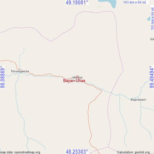
| Upper-left | 49.18081°, | 98.08869° |
| Center: | 48.71906°, | 98.79181° |
| Lower-right: | 48.25303°, | 99.49494° |
| Map W x H: | 103.2×103.2 km | = 64.1×64.1mi |
| max Lat: | 51.50725° ⇑28.5% North |
| Bayan-Uhaa: | 48.71906° |
| min Lat: | ⇓71.5% South 42.84199° |
| min Long | Bayan-Uhaa | max Long |
| 89.14358° | 98.79181° | 118.51014° |
| W 28.5%⇐ | ⇒71.5% E |
Elevation
Elevation of Bayan-Uhaa is 1648 m = 5407 ft, and this is 231.5 m = 760 ft above average elevation for this country.
| Max E: |
2800 m = 9186 ft | 27.6% |
| Bayan-Uhaa | 1648 m 5407 ft | |
| Avg. | 1416.5 m = 4647 ft | |
Min E: |
619 m = 2031 ft | 72.4% |
See also: Mongolia elevation on elevation.city.
Geographical zone
Bayan-Uhaa is located in North temperate zone (between Tropic of Cancer and the Arctic Circle). Distance of this North polar circle is 1984.1 km =1232.9 mi to North.| Distance of | km | miles | from Bayan-Uhaa |
|---|---|---|---|
| North Pole | 4590 | 2852.1 | to North |
| Arctic Circle | 1984.1 | 1232.9 | to North |
| Tropic Cancer | 2811.1 | 1746.7 | to South |
| Equator | 5417.1 | 3366 | to South |


Nearby cities:
15 places around Bayan-Uhaa: (largest is in red/bold)
• Bayan
98.9 km =61.5 mi,  36°
36°
• Dzuunmod
118.3 km =73.5 mi,  242°
242°
• Erdenet
60.2 km =37.4 mi,  64°
64°
• Halban
118.1 km =73.4 mi,  319°
319°
• Horgo
101.3 km =62.9 mi,  127°
127°
• Hunt
107.1 km =66.5 mi,  152°
152°
• Hödrögö
135.1 km =83.9 mi,  277°
277°
• Ider
79.6 km =49.5 mi,  85°
85°
• Jargalant
124.6 km =77.4 mi, 59°
• Mandal
139.3 km =86.6 mi,  19°
19°
• Orgil
43.6 km =27.1 mi,  109°
109°
• Sharga
120.2 km =74.7 mi,  0°
0°
• Telmin Suma
86.5 km =53.7 mi,  264°
264°
• Tosontsengel
37.5 km =23.3 mi, 276°
• Tsahir
71.2 km =44.2 mi,  176°
176°
Sources, notices
• [Note1] Compared only with cities in Mongolia existing in our database
• [Src1] Map data: © OpenStreetMap contributors (CC-BY-SA)
• [Src2] Other city data from geonames.org with taken over terms of usage.
• [Src3] Geographical zone / Annual Mean Temperature by Robert A. Rohde @ Wikipedia
