Tapayula geodata
Tapayula (Puebla) is a populated place; located in Mexico in America/Mexico_City (GMT-6) time zone. With population of 648 people, there are 13366 cities with bigger population in this country. Compared to other cities in Mexico, 57.3% of cities are located further ↓South; 66.7% of cities are located further ←West and 55.6% of cities have higher elevation than Tapayula. Note1


Tapayula GPS coordinates[2]
20° 1' 5.916" North, 97° 44' 39.12" West
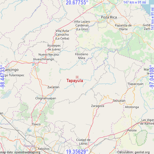
| Map corner | latitude | longitude |
|---|---|---|
| Upper-left | 20.67755°, | -98.44733° |
| Center: | 20.01831°, | -97.7442° |
| Lower-right: | 19.35629°, | -97.04108° |
| Map W x H: | 146.9×146.9 km | = 91.3×91.3mi |
| max Lat: | 32.7° ⇑42.7% North |
| Tapayula: | 20.01831° |
| min Lat: | ⇓57.3% South 14.53588° |
| min Long | Tapayula | max Long |
| -117.105° | -97.7442° | -86.73105° |
| W 66.7%⇐ | ⇒33.3% E |
Elevation
Elevation of Tapayula is 1175 m = 3855 ft, and this is 78.7 m = 258 ft below average elevation for this country.
| Max E: |
3497 m = 11473 ft | 55.6% |
| Avg. | 1253.7 m = 4113 ft | |
| Tapayula | 1175 m = 3855 ft | |
Min E: |
-1 m = -3 ft | 44.4% |
See also: Mexico elevation on elevation.city.
Geographical zone
Tapayula is located in North Torrid zone (between Equator and Tropic of Cancer). Distance of this Northern Tropic circle is 380.1 km =236.2 mi to North.| Distance of | km | miles | from Tapayula |
|---|---|---|---|
| North Pole | 7781.2 | 4835 | to North |
| Arctic Circle | 5175.3 | 3215.8 | to North |
| Tropic Cancer | 380.1 | 236.2 | to North |
| Equator | 2225.8 | 1383 | to South |


Nearby cities:
15 places around Tapayula: (largest is in red/bold)
• Amixtlán
6.6 km =4.1 mi,  299°
299°
• Camocuautla
2.7 km =1.7 mi,  325°
325°
• Chipahuatlán
7.5 km =4.7 mi,  50°
50°
• Coatepec
4.9 km =3 mi,  15°
15°
• Coyay
7.4 km =4.6 mi,  351°
351°
• Cuarta Sección
7.4 km =4.6 mi,  132°
132°
• Cuautotola
7.9 km =4.9 mi,  314°
314°
• Hueytlalpan
5 km =3.1 mi,  78°
78°
• Huitzilan
7.7 km =4.8 mi,  137°
137°
• Nanacatlán
7.3 km =4.5 mi,  102°
102°
• Tenepanigia (Santa Elena)
6.5 km =4 mi,  206°
206°
• Tepango
5.7 km =3.5 mi,  252°
252°
• Zapotitlán
3.6 km =2.2 mi,  119°
119°
• Zitlala
8.2 km =5.1 mi, 76°
• Zongozotla
4.7 km =2.9 mi,  158°
158°
Sources, notices
• [Note1] Compared only with cities in Mexico existing in our database
• [Src1] Map data: © OpenStreetMap contributors (CC-BY-SA)
• [Src2] Other city data from geonames.org with taken over terms of usage.
• [Src3] Geographical zone / Annual Mean Temperature by Robert A. Rohde @ Wikipedia
