Hueytlalpan geodata
Hueytlalpan (Puebla) is a populated place; located in Mexico in America/Mexico_City (GMT-6) time zone. With population of 2,023 people, there are 4300 cities with bigger population in this country. Compared to other cities in Mexico, 57.5% of cities are located further ↓South; 67.3% of cities are located further ←West and 60.9% of cities have higher elevation than Hueytlalpan. Note1


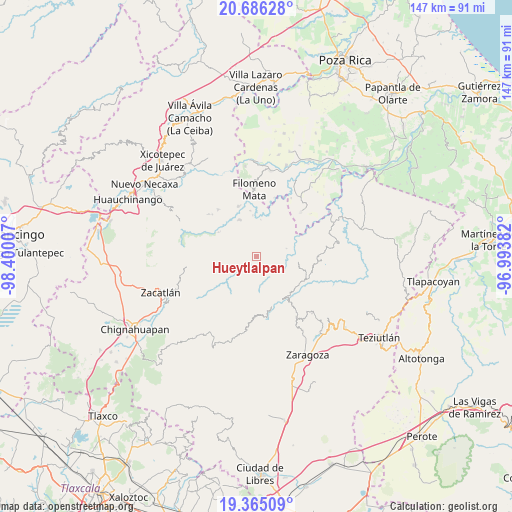
Hueytlalpan GPS coordinates[2]
20° 1' 37.452" North, 97° 41' 48.984" West
| Map corner | latitude | longitude |
|---|---|---|
| Upper-left | 20.68628°, | -98.40007° |
| Center: | 20.02707°, | -97.69694° |
| Lower-right: | 19.36509°, | -96.99382° |
| Map W x H: | 146.9×146.9 km | = 91.3×91.3mi |
| max Lat: | 32.7° ⇑42.5% North |
| Hueytlalpan: | 20.02707° |
| min Lat: | ⇓57.5% South 14.53588° |
| min Long | Hueytlalpan | max Long |
| -117.105° | -97.69694° | -86.73105° |
| W 67.3%⇐ | ⇒32.7% E |
Elevation
Elevation of Hueytlalpan is 943 m = 3094 ft, and this is 310.7 m = 1019 ft below average elevation for this country.
| Max E: |
3497 m = 11473 ft | 60.9% |
| Avg. | 1253.7 m = 4113 ft | |
| Hueytlalpan | 943 m = 3094 ft | |
Min E: |
-1 m = -3 ft | 39.1% |
See also: Mexico elevation on elevation.city.
Geographical zone
Hueytlalpan is located in North Torrid zone (between Equator and Tropic of Cancer). Distance of this Northern Tropic circle is 379.1 km =235.6 mi to North.| Distance of | km | miles | from Hueytlalpan |
|---|---|---|---|
| North Pole | 7780.3 | 4834.5 | to North |
| Arctic Circle | 5174.4 | 3215.2 | to North |
| Tropic Cancer | 379.1 | 235.6 | to North |
| Equator | 2226.8 | 1383.7 | to South |


Nearby cities:
15 places around Hueytlalpan: (largest is in red/bold)
• Bibiano Hernández
6.3 km =3.9 mi,  358°
358°
• Camocuautla
6.5 km =4 mi,  280°
280°
• Chipahuatlán
3.9 km =2.4 mi,  12°
12°
• Coatepec
5.2 km =3.2 mi,  316°
316°
• Cuarta Sección
6 km =3.7 mi,  175°
175°
• Huitzilan
6.6 km =4.1 mi, 177°
• Ixtepec
5.3 km =3.3 mi,  92°
92°
• Nanacatlán
3.4 km =2.1 mi,  139°
139°
• San Martín
6.1 km =3.8 mi,  110°
110°
• San Miguel del Progreso
5.2 km =3.2 mi, 142°
• Tapayula
5 km =3.1 mi,  258°
258°
• Tuxtla
5.3 km =3.3 mi,  124°
124°
• Zapotitlán
3.3 km =2.1 mi,  212°
212°
• Zitlala
3.1 km =1.9 mi,  73°
73°
• Zongozotla
6.2 km =3.9 mi, 211°
Sources, notices
• [Note1] Compared only with cities in Mexico existing in our database
• [Src1] Map data: © OpenStreetMap contributors (CC-BY-SA)
• [Src2] Other city data from geonames.org with taken over terms of usage.
• [Src3] Geographical zone / Annual Mean Temperature by Robert A. Rohde @ Wikipedia
