Lázaro Cárdenas geodata
Lázaro Cárdenas (Chiapas) is a populated place; located in Mexico in America/Mexico_City (GMT-6) time zone. With population of 937 people, there are 9304 cities with bigger population in this country. Compared to other cities in Mexico, 84.6% of cities are located further ↑North; 96.2% of cities are located further ←West and 79.1% of cities have higher elevation than Lázaro Cárdenas. Note1


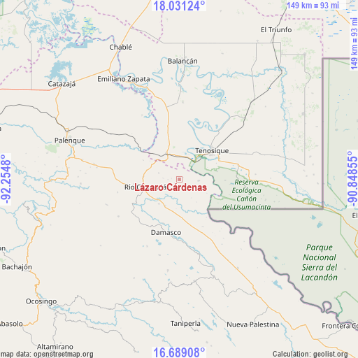
Lázaro Cárdenas GPS coordinates[2]
17° 21' 41.004" North, 91° 33' 6.012" West
| Map corner | latitude | longitude |
|---|---|---|
| Upper-left | 18.03124°, | -92.2548° |
| Center: | 17.36139°, | -91.55167° |
| Lower-right: | 16.68908°, | -90.84855° |
| Map W x H: | 149.2×149.2 km | = 92.7×92.7mi |
| max Lat: | 32.7° ⇑84.6% North |
| Lázaro Cárdenas: | 17.36139° |
| min Lat: | ⇓15.4% South 14.53588° |
| min Long | Lázaro Cárden | max Long |
| -117.105° | -91.55167° | -86.73105° |
| W 96.2%⇐ | ⇒3.8% E |
Elevation
Elevation of Lázaro Cárdenas is 110 m = 361 ft, and this is 1143.7 m = 3752 ft below average elevation for this country.
| Max E: |
3497 m = 11473 ft | 79.1% |
| Avg. | 1253.7 m = 4113 ft | |
| Lázaro Cárdenas | 110 m = 361 ft | |
Min E: |
-1 m = -3 ft | 20.9% |
See also: Mexico elevation on elevation.city.
Geographical zone
Lázaro Cárdenas is located in North Torrid zone (between Equator and Tropic of Cancer). Distance of this Northern Tropic circle is 675.5 km =419.7 mi to North.| Distance of | km | miles | from Lázaro Cárdenas |
|---|---|---|---|
| North Pole | 8076.7 | 5018.6 | to North |
| Arctic Circle | 5470.8 | 3399.4 | to North |
| Tropic Cancer | 675.5 | 419.7 | to North |
| Equator | 1930.4 | 1199.5 | to South |


Nearby cities:
15 places around Lázaro Cárdenas: (largest is in red/bold)
• Arena de Hidalgo
11.5 km =7.1 mi,  340°
340°
• Certeza
22.3 km =13.9 mi,  60°
60°
• Cristóbal Colón
20.6 km =12.8 mi,  203°
203°
• El Clavo
8.8 km =5.5 mi,  287°
287°
• El Desierto
16.8 km =10.4 mi,  298°
298°
• El Edén
9.8 km =6.1 mi,  184°
184°
• La Isla
15 km =9.3 mi,  28°
28°
• La Reforma de Ocampo
16.1 km =10 mi,  250°
250°
• Nueva Samaria
19.4 km =12.1 mi, 199°
• Río Chancalá
14.4 km =8.9 mi,  258°
258°
• San José Pathuitz
22.5 km =14 mi,  211°
211°
• San Juan Chancalaíto
18.6 km =11.6 mi, 263°
• San Martín Chamizal
12.2 km =7.6 mi, 208°
• Tenosique
18.4 km =11.4 mi,  47°
47°
• Usumacinta
22.2 km =13.8 mi,  16°
16°
Sources, notices
• [Note1] Compared only with cities in Mexico existing in our database
• [Src1] Map data: © OpenStreetMap contributors (CC-BY-SA)
• [Src2] Other city data from geonames.org with taken over terms of usage.
• [Src3] Geographical zone / Annual Mean Temperature by Robert A. Rohde @ Wikipedia
