Zunu y Patastal geodata
Zunu y Patastal (Tabasco) is a populated place; located in Mexico in America/Mexico_City (GMT-6) time zone. With population of 747 people, there are 11723 cities with bigger population in this country. Compared to other cities in Mexico, 83.4% of cities are located further ↑North; 89.8% of cities are located further ←West and 83.3% of cities have higher elevation than Zunu y Patastal. Note1


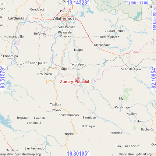
Zunu y Patastal GPS coordinates[2]
17° 28' 25.86" North, 92° 48' 45.576" West
| Map corner | latitude | longitude |
|---|---|---|
| Upper-left | 18.14328°, | -93.51579° |
| Center: | 17.47385°, | -92.81266° |
| Lower-right: | 16.80195°, | -92.10954° |
| Map W x H: | 149.1×149.1 km | = 92.6×92.6mi |
| max Lat: | 32.7° ⇑83.4% North |
| Zunu y Patastal: | 17.47385° |
| min Lat: | ⇓16.6% South 14.53588° |
| min Long | Zunu y Patastal | max Long |
| -117.105° | -92.81266° | -86.73105° |
| W 89.8%⇐ | ⇒10.2% E |
Elevation
Elevation of Zunu y Patastal is 58 m = 190 ft, and this is 1195.7 m = 3923 ft below average elevation for this country.
| Max E: |
3497 m = 11473 ft | 83.3% |
| Avg. | 1253.7 m = 4113 ft | |
| Zunu y Patastal | 58 m = 190 ft | |
Min E: |
-1 m = -3 ft | 16.7% |
See also: Mexico elevation on elevation.city.
Geographical zone
Zunu y Patastal is located in North Torrid zone (between Equator and Tropic of Cancer). Distance of this Northern Tropic circle is 663 km =412 mi to North.| Distance of | km | miles | from Zunu y Patastal |
|---|---|---|---|
| North Pole | 8064.2 | 5010.9 | to North |
| Arctic Circle | 5458.3 | 3391.6 | to North |
| Tropic Cancer | 663 | 412 | to North |
| Equator | 1942.9 | 1207.3 | to South |


Nearby cities:
15 places around Zunu y Patastal: (largest is in red/bold)
• Amatán
11.1 km =6.9 mi,  183°
183°
• Ceiba 2da. Sección (San Luis)
13.3 km =8.3 mi,  343°
343°
• Cuauhtémoc Barreal
10.8 km =6.7 mi,  118°
118°
• Francisco I. Madero
11.8 km =7.3 mi,  252°
252°
• Guadalupe Victoria
13.3 km =8.3 mi,  208°
208°
• La Gloria
15.4 km =9.6 mi,  256°
256°
• Libertad
12.5 km =7.8 mi, 124°
• Oxolotán
12.5 km =7.8 mi,  147°
147°
• Puxcatán
13.6 km =8.5 mi,  100°
100°
• Reforma y Planada
11.2 km =7 mi, 210°
• San Ramón
11.4 km =7.1 mi,  357°
357°
• Tacotalpa
13.7 km =8.5 mi,  354°
354°
• Tapijulapa
3.8 km =2.4 mi,  110°
110°
• Vicente Guerrero
12.4 km =7.7 mi,  290°
290°
• Xicoténcatl
12.5 km =7.8 mi,  66°
66°
Sources, notices
• [Note1] Compared only with cities in Mexico existing in our database
• [Src1] Map data: © OpenStreetMap contributors (CC-BY-SA)
• [Src2] Other city data from geonames.org with taken over terms of usage.
• [Src3] Geographical zone / Annual Mean Temperature by Robert A. Rohde @ Wikipedia
