Xicoténcatl geodata
Xicoténcatl (Tabasco) is a populated place; located in Mexico in America/Mexico_City (GMT-6) time zone. With population of 1,474 people, there are 5858 cities with bigger population in this country. Compared to other cities in Mexico, 82.9% of cities are located further ↑North; 90.5% of cities are located further ←West and 85.1% of cities have higher elevation than Xicoténcatl. Note1


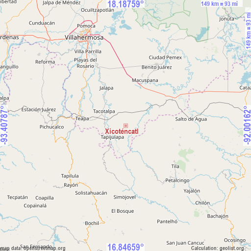
Xicoténcatl GPS coordinates[2]
17° 31' 5.988" North, 92° 42' 17.064" West
| Map corner | latitude | longitude |
|---|---|---|
| Upper-left | 18.18759°, | -93.40787° |
| Center: | 17.51833°, | -92.70474° |
| Lower-right: | 16.84659°, | -92.00162° |
| Map W x H: | 149.1×149.1 km | = 92.6×92.6mi |
| max Lat: | 32.7° ⇑82.9% North |
| Xicoténcatl: | 17.51833° |
| min Lat: | ⇓17.1% South 14.53588° |
| min Long | Xicoténcatl | max Long |
| -117.105° | -92.70474° | -86.73105° |
| W 90.5%⇐ | ⇒9.5% E |
Elevation
Elevation of Xicoténcatl is 43 m = 141 ft, and this is 1210.7 m = 3972 ft below average elevation for this country.
| Max E: |
3497 m = 11473 ft | 85.1% |
| Avg. | 1253.7 m = 4113 ft | |
| Xicoténcatl | 43 m = 141 ft | |
Min E: |
-1 m = -3 ft | 14.9% |
See also: Mexico elevation on elevation.city.
Geographical zone
Xicoténcatl is located in North Torrid zone (between Equator and Tropic of Cancer). Distance of this Northern Tropic circle is 658.1 km =408.9 mi to North.| Distance of | km | miles | from Xicoténcatl |
|---|---|---|---|
| North Pole | 8059.2 | 5007.8 | to North |
| Arctic Circle | 5453.3 | 3388.5 | to North |
| Tropic Cancer | 658.1 | 408.9 | to North |
| Equator | 1947.9 | 1210.4 | to South |


Nearby cities:
15 places around Xicoténcatl: (largest is in red/bold)
• Agua Blanca
9.5 km =5.9 mi,  112°
112°
• Cuauhtémoc Barreal
10.3 km =6.4 mi,  190°
190°
• El Bebedero
14.7 km =9.1 mi,  155°
155°
• Guayal
11.3 km =7 mi,  80°
80°
• Jesús Carranza
13 km =8.1 mi, 155°
• Libertad
12.1 km =7.5 mi, 185°
• Lomas Alegres 1ra. Sección
9.1 km =5.7 mi,  31°
31°
• Oxolotán
16.1 km =10 mi,  197°
197°
• Pochitocal 1ra. Sección (La Palma)
13 km =8.1 mi,  341°
341°
• Puxcatán
7.7 km =4.8 mi,  166°
166°
• Raya Zaragoza
12.7 km =7.9 mi, 170°
• San Ramón
13.5 km =8.4 mi,  298°
298°
• Tacotalpa
15.5 km =9.6 mi, 304°
• Tapijulapa
10.1 km =6.3 mi,  231°
231°
• Zunu y Patastal
12.5 km =7.8 mi,  246°
246°
Sources, notices
• [Note1] Compared only with cities in Mexico existing in our database
• [Src1] Map data: © OpenStreetMap contributors (CC-BY-SA)
• [Src2] Other city data from geonames.org with taken over terms of usage.
• [Src3] Geographical zone / Annual Mean Temperature by Robert A. Rohde @ Wikipedia
