Guapalaina geodata
Guapalaina (Chihuahua) is a populated place; located in Mexico in America/Chihuahua (GMT-6) time zone. With population of 508 people, there are 16554 cities with bigger population in this country. Compared to other cities in Mexico, 96.6% of cities are located further ↓South; 95.5% of cities are located further →East and 68% of cities have higher elevation than Guapalaina. Note1


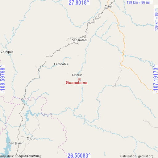
Guapalaina GPS coordinates[2]
27° 10' 41.052" North, 107° 53' 41.46" West
| Map corner | latitude | longitude |
|---|---|---|
| Upper-left | 27.8018°, | -108.59798° |
| Center: | 27.17807°, | -107.89485° |
| Lower-right: | 26.55083°, | -107.19173° |
| Map W x H: | 139.1×139.1 km | = 86.4×86.4mi |
| max Lat: | 32.7° ⇑3.4% North |
| Guapalaina: | 27.17807° |
| min Lat: | ⇓96.6% South 14.53588° |
| min Long | Guapalaina | max Long |
| -117.105° | -107.89485° | -86.73105° |
| W 4.5%⇐ | ⇒95.5% E |
Elevation
Elevation of Guapalaina is 531 m = 1742 ft, and this is 722.7 m = 2371 ft below average elevation for this country.
| Max E: |
3497 m = 11473 ft | 68% |
| Avg. | 1253.7 m = 4113 ft | |
| Guapalaina | 531 m = 1742 ft | |
Min E: |
-1 m = -3 ft | 32% |
See also: Mexico elevation on elevation.city.
Geographical zone
Guapalaina is located in North temperate zone (between Tropic of Cancer and the Arctic Circle). Distance of this Northern Tropic circle is 416 km =258.5 mi to South.| Distance of | km | miles | from Guapalaina |
|---|---|---|---|
| North Pole | 6985.1 | 4340.3 | to North |
| Arctic Circle | 4379.3 | 2721.2 | to North |
| Tropic Cancer | 416 | 258.5 | to South |
| Equator | 3021.9 | 1877.7 | to South |


Nearby cities:
15 places around Guapalaina: (largest is in red/bold)
• Bahuichivo
30.9 km =19.2 mi,  326°
326°
• Bajosori
73.7 km =45.8 mi,  222°
222°
• Batopilas
22.5 km =14 mi,  137°
137°
• Cerocahui
20.8 km =12.9 mi,  310°
310°
• Choix
67.4 km =41.9 mi, 219°
• Chínipas
67.9 km =42.2 mi,  290°
290°
• Creel
68.6 km =42.6 mi,  21°
21°
• Milpillas
74.2 km =46.1 mi,  272°
272°
• Morelos
60.2 km =37.4 mi,  158°
158°
• Polanco (Ranchería Mineral Polanco)
46.1 km =28.6 mi,  146°
146°
• Samachique
37.8 km =23.5 mi,  68°
68°
• San Rafael
35.5 km =22.1 mi,  0°
0°
• Témoris
39.5 km =24.5 mi, 285°
• Urique
4.2 km =2.6 mi, 332°
• Yoquivo
39.5 km =24.5 mi,  115°
115°
Sources, notices
• [Note1] Compared only with cities in Mexico existing in our database
• [Src1] Map data: © OpenStreetMap contributors (CC-BY-SA)
• [Src2] Other city data from geonames.org with taken over terms of usage.
• [Src3] Geographical zone / Annual Mean Temperature by Robert A. Rohde @ Wikipedia
