Guachochi geodata
Guachochi (Chihuahua) is a seat of a second-order administrative division; located in Mexico in America/Chihuahua (GMT-6) time zone. With population of 14,513 people, there are 669 cities with bigger population in this country. Compared to other cities in Mexico, 96% of cities are located further ↓South; 94.5% of cities are located further →East and 89.7% of cities have lower elevation than Guachochi. Note1


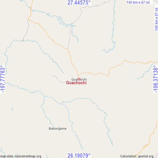
Guachochi GPS coordinates[2]
26° 49' 12.036" North, 107° 4' 28.2" West
| Map corner | latitude | longitude |
|---|---|---|
| Upper-left | 27.44575°, | -107.77763° |
| Center: | 26.82001°, | -107.0745° |
| Lower-right: | 26.19079°, | -106.37138° |
| Map W x H: | 139.5×139.5 km | = 86.7×86.7mi |
| max Lat: | 32.7° ⇑4% North |
| Guachochi: | 26.82001° |
| min Lat: | ⇓96% South 14.53588° |
| min Long | Guachochi | max Long |
| -117.105° | -107.0745° | -86.73105° |
| W 5.5%⇐ | ⇒94.5% E |
Elevation
Elevation of Guachochi is 2398 m = 7867 ft, and this is 1144.3 m = 3754 ft above average elevation for this country.
| Max E: |
3497 m = 11473 ft | 10.3% |
| Guachochi | 2398 m 7867 ft | |
| Avg. | 1253.7 m = 4113 ft | |
Min E: |
-1 m = -3 ft | 89.7% |
See also: Mexico elevation on elevation.city.
Geographical zone
Guachochi is located in North temperate zone (between Tropic of Cancer and the Arctic Circle). Distance of this Northern Tropic circle is 376.2 km =233.8 mi to South.| Distance of | km | miles | from Guachochi |
|---|---|---|---|
| North Pole | 7025 | 4365.1 | to North |
| Arctic Circle | 4419.1 | 2745.9 | to North |
| Tropic Cancer | 376.2 | 233.8 | to South |
| Equator | 2982.1 | 1853 | to South |


Nearby cities:
15 places around Guachochi: (largest is in red/bold)
• Baborigame
47.5 km =29.5 mi,  203°
203°
• Balleza
73.4 km =45.6 mi,  78°
78°
• Batopilas
70 km =43.5 mi,  289°
289°
• Ejido El Vergel
78.9 km =49 mi,  119°
119°
• El Tule
84.3 km =52.4 mi,  72°
72°
• Guadalupe y Calvo
81.8 km =50.8 mi,  172°
172°
• Mariano Balleza
73.8 km =45.9 mi, 78°
• Morelos
62 km =38.5 mi,  254°
254°
• Nonoava
80 km =49.7 mi,  24°
24°
• Norogachi
50.8 km =31.6 mi,  353°
353°
• Polanco (Ranchería Mineral Polanco)
55.7 km =34.6 mi,  271°
271°
• Samachique
70.6 km =43.9 mi,  319°
319°
• San Pedro de Chinatú (Ranchería San Pedro)
83.7 km =52 mi,  147°
147°
• Turuachi
85 km =52.8 mi, 154°
• Yoquivo
51 km =31.7 mi,  296°
296°
Sources, notices
• [Note1] Compared only with cities in Mexico existing in our database
• [Src1] Map data: © OpenStreetMap contributors (CC-BY-SA)
• [Src2] Other city data from geonames.org with taken over terms of usage.
• [Src3] Geographical zone / Annual Mean Temperature by Robert A. Rohde @ Wikipedia
