Téra geodata
Téra (Tillabéri) is a seat of a second-order administrative division; located in Niger in Africa/Niamey (GMT+1) time zone. With population of 21,095 people, there are 15 cities with bigger population in this country. Compared to other cities in Niger, 55.8% of cities are located further ↓South; 100% of cities are located further →East and 72.1% of cities have higher elevation than Téra. Note1


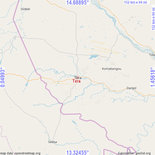
Téra GPS coordinates[2]
14° 0' 27.936" North, 0° 45' 11.016" East
| Map corner | latitude | longitude |
|---|---|---|
| Upper-left | 14.68895°, | 0.04993° |
| Center: | 14.00776°, | 0.75306° |
| Lower-right: | 13.32455°, | 1.45618° |
| Map W x H: | 151.7×151.7 km | = 94.3×94.3mi |
| max Lat: | 18.73694° ⇑44.2% North |
| Téra: | 14.00776° |
| min Lat: | ⇓55.8% South 11.88435° |
| min Long | Téra | max Long |
| 0.75306° | 0.75306° | 13.10921° |
| W 0%⇐ | ⇒100% E |
Elevation
Elevation of Téra is 248 m = 814 ft, and this is 94.8 m = 311 ft below average elevation for this country.
| Max E: |
525 m = 1722 ft | 72.1% |
| Avg. | 342.8 m = 1125 ft | |
| Téra | 248 m = 814 ft | |
Min E: |
177 m = 581 ft | 27.9% |
See also: Niger elevation on elevation.city.
Geographical zone
Téra is located in North Torrid zone (between Equator and Tropic of Cancer). Distance of this Northern Tropic circle is 1048.4 km =651.4 mi to North.| Distance of | km | miles | from Téra |
|---|---|---|---|
| North Pole | 8449.5 | 5250.3 | to North |
| Arctic Circle | 5843.7 | 3631.1 | to North |
| Tropic Cancer | 1048.4 | 651.4 | to North |
| Equator | 1557.5 | 967.8 | to South |


Nearby cities:
12 places around Téra: (largest is in red/bold)
• Ayorou
82.3 km =51.1 mi,  12°
12°
• Birnin Gaouré
255 km =158.4 mi,  113°
113°
• Dogondoutchi
355.8 km =221.1 mi,  96°
96°
• Dosso
284.6 km =176.8 mi, 112°
• Filingué
279 km =173.4 mi,  82°
82°
• Gaya
375.6 km =233.4 mi,  128°
128°
• Kollo
188.4 km =117.1 mi, 114°
• Loga
271.6 km =168.8 mi, 99°
• Niamey
156.5 km =97.2 mi, 110°
• Ouallam
147.7 km =91.8 mi, 76°
• Say
201.7 km =125.3 mi,  120°
120°
• Tillabéri
78.8 km =49 mi,  73°
73°
Sources, notices
• [Note1] Compared only with cities in Niger existing in our database
• [Src1] Map data: © OpenStreetMap contributors (CC-BY-SA)
• [Src2] Other city data from geonames.org with taken over terms of usage.
• [Src3] Geographical zone / Annual Mean Temperature by Robert A. Rohde @ Wikipedia
