Oguma geodata
Oguma (Kogi) is a seat of a second-order administrative division; located in Nigeria in Africa/Lagos (GMT+1) time zone. In our database, there are 451 cities with bigger population. Compared to other cities in Nigeria, 54.3% of cities are located further ↑North; 55.2% of cities are located further →East and 86.5% of cities have higher elevation than Oguma. Note1


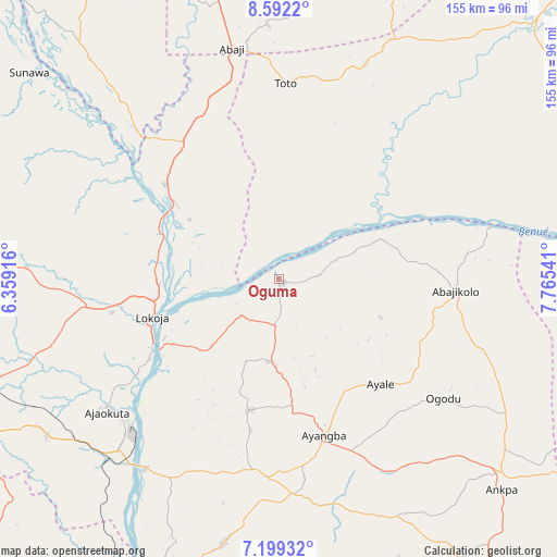
Oguma GPS coordinates[2]
7° 53' 46.86" North, 7° 3' 44.244" East
| Map corner | latitude | longitude |
|---|---|---|
| Upper-left | 8.5922°, | 6.35916° |
| Center: | 7.89635°, | 7.06229° |
| Lower-right: | 7.19932°, | 7.76541° |
| Map W x H: | 154.9×154.9 km | = 96.3×96.3mi |
| max Lat: | 13.7543° ⇑54.3% North |
| Oguma: | 7.89635° |
| min Lat: | ⇓45.7% South 4.31231° |
| min Long | Oguma | max Long |
| 2.73333° | 7.06229° | 14.46552° |
| W 44.8%⇐ | ⇒55.2% E |
Elevation
Elevation of Oguma is 52 m = 171 ft, and this is 244.5 m = 802 ft below average elevation for this country.
| Max E: |
1599 m = 5246 ft | 86.5% |
| Avg. | 296.5 m = 973 ft | |
| Oguma | 52 m = 171 ft | |
Min E: |
2 m = 7 ft | 13.5% |
See also: Nigeria elevation on elevation.city.
Geographical zone
Oguma is located in North Torrid zone (between Equator and Tropic of Cancer). Distance of Equator is 878 km =545.6 mi to South.| Distance of | km | miles | from Oguma |
|---|---|---|---|
| North Pole | 9129.1 | 5672.6 | to North |
| Arctic Circle | 6523.2 | 4053.3 | to North |
| Tropic Cancer | 1727.9 | 1073.7 | to North |
| Equator | 878 | 545.6 | to South |


Nearby cities:
15 places around Oguma: (largest is in red/bold)
• Abaji
65.5 km =40.7 mi,  348°
348°
• Abejukolo
49.3 km =30.6 mi,  93°
93°
• Abocho
37.5 km =23.3 mi,  192°
192°
• Adogo
77.2 km =48 mi,  236°
236°
• Ajaka
84.4 km =52.4 mi,  198°
198°
• Ajaokuta
58.3 km =36.2 mi,  230°
230°
• Ankpa
83.4 km =51.8 mi,  131°
131°
• Buga
72.9 km =45.3 mi,  24°
24°
• Bugana
58.5 km =36.4 mi,  78°
78°
• Dekina
23.1 km =14.4 mi, 185°
• Icheu
38.3 km =23.8 mi, 236°
• Koton-Karfe
36.3 km =22.6 mi,  306°
306°
• Lokoja
37.1 km =23.1 mi,  252°
252°
• Toto
54.6 km =33.9 mi,  1°
1°
• Ugwolawo
74.9 km =46.5 mi, 191°
Sources, notices
• [Note1] Compared only with cities in Nigeria existing in our database
• [Src1] Map data: © OpenStreetMap contributors (CC-BY-SA)
• [Src2] Other city data from geonames.org with taken over terms of usage.
• [Src3] Geographical zone / Annual Mean Temperature by Robert A. Rohde @ Wikipedia
