Lokoja geodata
Lokoja (Kogi) is a seat of a first-order administrative division; located in Nigeria in Africa/Lagos (GMT+1) time zone. With population of 60,579 people, there are 144 cities with bigger population in this country. Compared to other cities in Nigeria, 56.1% of cities are located further ↑North; 61.9% of cities are located further →East and 86.1% of cities have higher elevation than Lokoja. Note1


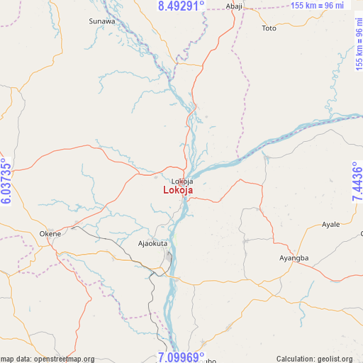
Lokoja GPS coordinates[2]
7° 47' 48.768" North, 6° 44' 25.728" East
| Map corner | latitude | longitude |
|---|---|---|
| Upper-left | 8.49291°, | 6.03735° |
| Center: | 7.79688°, | 6.74048° |
| Lower-right: | 7.09969°, | 7.4436° |
| Map W x H: | 154.9×154.9 km | = 96.3×96.3mi |
| max Lat: | 13.7543° ⇑56.1% North |
| Lokoja: | 7.79688° |
| min Lat: | ⇓43.9% South 4.31231° |
| min Long | Lokoja | max Long |
| 2.73333° | 6.74048° | 14.46552° |
| W 38.1%⇐ | ⇒61.9% E |
Elevation
Elevation of Lokoja is 53 m = 174 ft, and this is 243.5 m = 799 ft below average elevation for this country.
| Max E: |
1599 m = 5246 ft | 86.1% |
| Avg. | 296.5 m = 973 ft | |
| Lokoja | 53 m = 174 ft | |
Min E: |
2 m = 7 ft | 13.9% |
See also: Lokoja elevation on elevation.city.
Geographical zone
Lokoja is located in North Torrid zone (between Equator and Tropic of Cancer). Distance of Equator is 866.9 km =538.7 mi to South.| Distance of | km | miles | from Lokoja |
|---|---|---|---|
| North Pole | 9140.1 | 5679.4 | to North |
| Arctic Circle | 6534.2 | 4060.2 | to North |
| Tropic Cancer | 1739 | 1080.6 | to North |
| Equator | 866.9 | 538.7 | to South |


Nearby cities:
15 places around Lokoja: (largest is in red/bold)
• Abocho
37.2 km =23.1 mi,  133°
133°
• Adogo
42.9 km =26.7 mi,  222°
222°
• Ajaka
69.9 km =43.4 mi,  172°
172°
• Ajaokuta
27.7 km =17.2 mi,  199°
199°
• Akpafa
74.5 km =46.3 mi,  240°
240°
• Dekina
35.5 km =22.1 mi,  109°
109°
• Icheu
10.6 km =6.6 mi,  161°
161°
• Kabba
73.4 km =45.6 mi,  272°
272°
• Koton-Karfe
33.3 km =20.7 mi,  10°
10°
• Obangede
62.8 km =39 mi,  251°
251°
• Ogaminana
61.8 km =38.4 mi, 248°
• Oguma
37.1 km =23.1 mi,  72°
72°
• Okene
61.9 km =38.5 mi, 243°
• Toto
75.4 km =46.9 mi,  29°
29°
• Ugwolawo
65.5 km =40.7 mi, 162°
Sources, notices
• [Note1] Compared only with cities in Nigeria existing in our database
• [Src1] Map data: © OpenStreetMap contributors (CC-BY-SA)
• [Src2] Other city data from geonames.org with taken over terms of usage.
• [Src3] Geographical zone / Annual Mean Temperature by Robert A. Rohde @ Wikipedia
