Kangiwa geodata
Kangiwa (Kebbi) is a seat of a second-order administrative division; located in Nigeria in Africa/Lagos (GMT+1) time zone. With population of 11,701 people, there are 303 cities with bigger population in this country. Compared to other cities in Nigeria, 91.2% of cities are located further ↓South; 93.7% of cities are located further →East and 56.7% of cities have higher elevation than Kangiwa. Note1


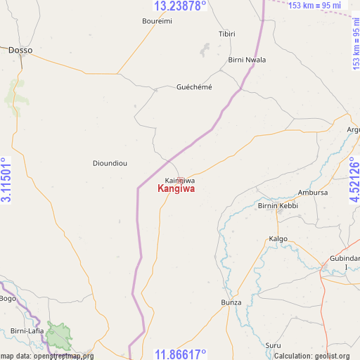
Kangiwa GPS coordinates[2]
12° 33' 12.204" North, 3° 49' 5.304" East
| Map corner | latitude | longitude |
|---|---|---|
| Upper-left | 13.23878°, | 3.11501° |
| Center: | 12.55339°, | 3.81814° |
| Lower-right: | 11.86617°, | 4.52126° |
| Map W x H: | 152.6×152.6 km | = 94.8×94.8mi |
| max Lat: | 13.7543° ⇑8.8% North |
| Kangiwa: | 12.55339° |
| min Lat: | ⇓91.2% South 4.31231° |
| min Long | Kangiwa | max Long |
| 2.73333° | 3.81814° | 14.46552° |
| W 6.3%⇐ | ⇒93.7% E |
Elevation
Elevation of Kangiwa is 237 m = 778 ft, and this is 59.5 m = 195 ft below average elevation for this country.
| Max E: |
1599 m = 5246 ft | 56.7% |
| Avg. | 296.5 m = 973 ft | |
| Kangiwa | 237 m = 778 ft | |
Min E: |
2 m = 7 ft | 43.3% |
See also: Nigeria elevation on elevation.city.
Geographical zone
Kangiwa is located in North Torrid zone (between Equator and Tropic of Cancer). Distance of this Northern Tropic circle is 1210.1 km =751.9 mi to North.| Distance of | km | miles | from Kangiwa |
|---|---|---|---|
| North Pole | 8611.3 | 5350.8 | to North |
| Arctic Circle | 6005.4 | 3731.6 | to North |
| Tropic Cancer | 1210.1 | 751.9 | to North |
| Equator | 1395.8 | 867.3 | to South |


Nearby cities:
15 places around Kangiwa: (largest is in red/bold)
• Aliero
76.8 km =47.7 mi,  112°
112°
• Argungu
79.6 km =49.5 mi,  74°
74°
• Augie
92.7 km =57.6 mi, 66°
• Birnin Kebbi
42.6 km =26.5 mi, 105°
• Bunza
56 km =34.8 mi,  157°
157°
• Dakingari
104.1 km =64.7 mi,  165°
165°
• Gulma
59.1 km =36.7 mi,  80°
80°
• Gwandu
89.7 km =55.7 mi,  93°
93°
• Jega
71.2 km =44.2 mi,  121°
121°
• Kalgo
48.6 km =30.2 mi, 121°
• Kamba
80 km =49.7 mi,  192°
192°
• Kebbe
110.2 km =68.5 mi, 115°
• Maiyama
79.5 km =49.4 mi,  131°
131°
• Silame
123.8 km =76.9 mi,  64°
64°
• Tambuwal
91.4 km =56.8 mi,  100°
100°
Sources, notices
• [Note1] Compared only with cities in Nigeria existing in our database
• [Src1] Map data: © OpenStreetMap contributors (CC-BY-SA)
• [Src2] Other city data from geonames.org with taken over terms of usage.
• [Src3] Geographical zone / Annual Mean Temperature by Robert A. Rohde @ Wikipedia
